Zetageist
Junior Member
Just some light readings for you guys regarding SCS and Okinotorishima Islands published last year when the Chinese reclamations started in SCS:
South China Sea: How Many Battalions Does the Passive Voice Have?
And...Island Games: Okinotorishima vs. Johnson South Reef
Japan extends its sea territory by 177,000 sq km in line with UN ruling
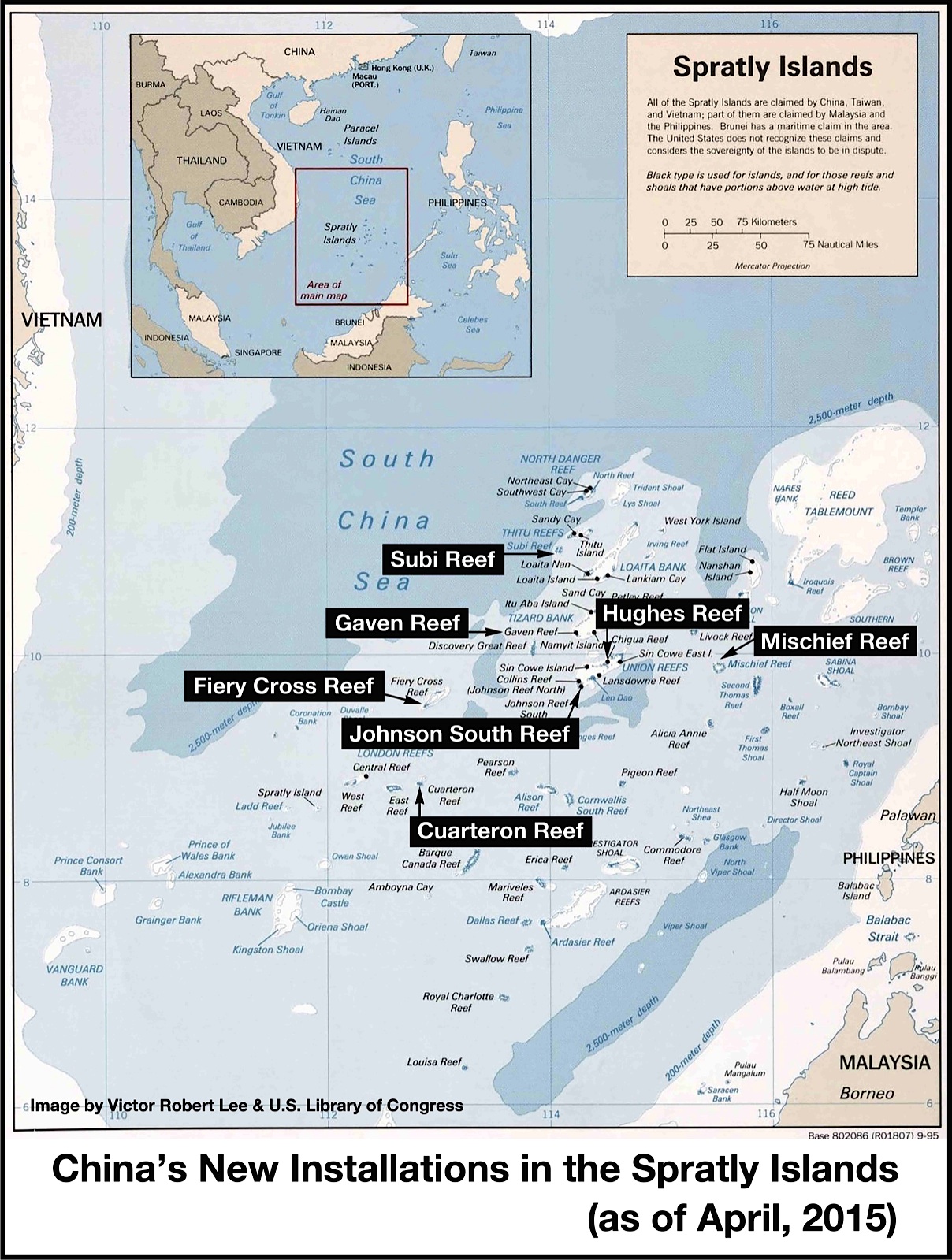
It would be funny to see if China were to build the exact same looking concrete platforms as Okinotorishima ones to protect 2 rock outcrops on the Fiery Cross Reef. One rock is 1 meter above high tide located on SW end (9˚33'N 112˚53'E), and the other one is 0.6 m above high tide at NE region of the reef.
South China Sea: How Many Battalions Does the Passive Voice Have?
And...Island Games: Okinotorishima vs. Johnson South Reef
Japan extends its sea territory by 177,000 sq km in line with UN ruling
It would be funny to see if China were to build the exact same looking concrete platforms as Okinotorishima ones to protect 2 rock outcrops on the Fiery Cross Reef. One rock is 1 meter above high tide located on SW end (9˚33'N 112˚53'E), and the other one is 0.6 m above high tide at NE region of the reef.
Last edited: