Zetageist
Junior Member
Revealed: China's Reasons for Island-Building in the South China Sea
For the first time, China’s Foreign Ministry went into detail on the purpose of land reclamation in the South China Sea.

By
April 10, 2015
For the first time, China’s Foreign Ministry went into detail on the purpose of land reclamation in the South China Sea.

By
April 10, 2015
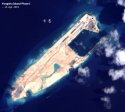
For the first time, China’s Foreign Ministry has explained in detail the purpose and rationale for large-scale land reclamation activities taking place in disputed areas of the South China Sea. China’s dredging and construction activities have caused fellow disputants, as well as the U.S., to criticize China for raising tensions by seeking to change the status quo.
China’s typical response when asked about the South China Sea is terse and tends to shut off, rather than invite, further discussion. For example, when Foreign Ministry spokesperson Hua Chunying was asked about China’s construction activities in the Spratly Islands, her response (in its entirety) was as follows:
China holds a clear and consistent stance on the South China Sea issue. China’s normal construction activities on our own islands and in our own waters are lawful, reasonable and justifiable. We hope that relevant party can take a calm view on this.
There’s really nothing to this other than a string of adjectives outlining China’s position. In essence, China is telling the world: our land reclamation is “normal,” “lawful,” “reasonable,” and “justifiable” – but take our word for it, as we’re not going to explain any further. It’s hard to argue something is “justifiable” if you don’t take the time to actually justify it.
Given the public relations blitz employed by the Philippines (and, to a lesser extent, Vietnam) against China’s land reclamation, Beijing has apparently decided to change its strategy. On April 9, when Hua was asked again about the land reclamation, she spoke at length, going into detail about the purpose of China’s construction work. Hua’s comments went on for several minutes – a far cry from the three-sentence response of March 3 (which was typical or previous responses). The same adjectives – “indisputable sovereignty,” “reasonable,” “justified,” “lawful” – appear, but this time along with an argument backing their use. For the first time, Hua explained clearlywhyChina is carrying out the reclamation activities.
According to Hua, China’s “maintenance and construction work” on garrisons located in the Spratlys has the following purposes:
[O]ptimizing their functions, improving the living and working conditions of personnel stationed there, better safeguarding territorial sovereignty and maritime rights and interests, as well as better performing China’s international responsibility and obligation in maritime search and rescue, disaster prevention and mitigation, marine science and research, meteorological observation, environmental protection, navigation safety, fishery production service and other areas.
There’s a lot here. First, China is justifying its activities are merely expanding existing garrisons — “improving” structures that were already there. Other South China Sea claimants have done the same over the years, a fact Beijing is always quick to point out. By highlighting the goals of “optimizing” and “improving” pre-existing structures, China is implying that its construction activities are no different than those undertaken previously by other claimants. Hua made this point explicit later in her remarks, when she accused China’s critics of having “an out-and-out double standard.” (China’s critics, of course, point out that China’s current activiites are unprecedented in terms of both scale and speed.)
Another point worth emphasizing is that China is attempting to frame its newly expanded garrisons as providers of the public good. Yes, they will be used (likely primarily) for “better safeguarding territorial sovereignty,” but Hua also provides a laundry list of anodyne uses for the new islands: maritime search and rescue, disaster prevention, marine research, even weather observation. As Hua emphasized later in her remarks, “After the construction, the islands and reefs will be able to provide all-round and comprehensive services to meet various civilian demands besides satisfying the need of necessary military defense.”
Hua pointed out that the South China Sea is a vital area for maritime shipping and fishing activities, but is located far from major land masses. China’s new construction will allow ships to “take shelter” from typhoons and other inclement weather, as well as providing “navigation aid, search and rescue … [and] fishery service and administration” to ships from China and its neighbors alike, Hua said.
Hua also promised that China’s construction would not harm the environment. “The ecological environment of the South China Sea will not be damaged,” Hua said firmly, saying China had conducted “scientific assessments and rigorous tests” before beginning construction. “We put equal emphasis on construction and protection by following a high standard of environmental protection and taking into full consideration the protection of ecological environment and fishing resources,” Hua said.
Hua’s conference is a welcome move (albeit a small one) toward increased transparency on the thorny South China Sea issue. China has now officially admitted that its construction activities will be used for military purposes, including to exert its claims to sovereignty in the region – but Beijing has also made its case for the islands playing a humanitarian function as well. That’s not likely to be particularly convincing to officials in Manila, Hanoi, or Washington, but at least the debate can move forward.


