You are using an out of date browser. It may not display this or other websites correctly.
You should upgrade or use an alternative browser.
You should upgrade or use an alternative browser.
PLAN SCS Bases/Islands/Vessels (Not a Strategy Page)
- Thread starter lilzz
- Start date


Recently a US Navy LCS went through the area...maybe that is what it is talking about. The US Navy made the following statement about that transit:What is the US Flotilla Route?

"As part of our strategic rebalance to bring our newest and most capable Navy platforms to the Indo-Asia-Pacific, a regular presence in Southeast Asia. Routine operations like the one USS Fort Worth just completed in the South China Sea will be the new normal as we welcome four LCSs to the region in the coming years," Capt. Fred Kacher, commodore of the Navy's Destroyer Squadron 7, said in the Navy release.
So my guess is that the "US Flotilla Route" shown here is the route that ship took and what some might expect to be the route used by future vessels...though I imagine the route will vary and never be predictable.
Geographer
Junior Member
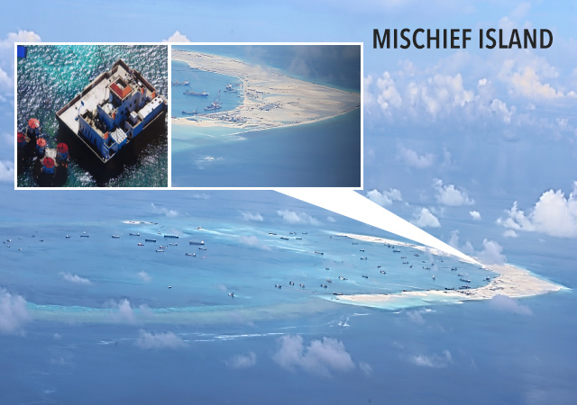
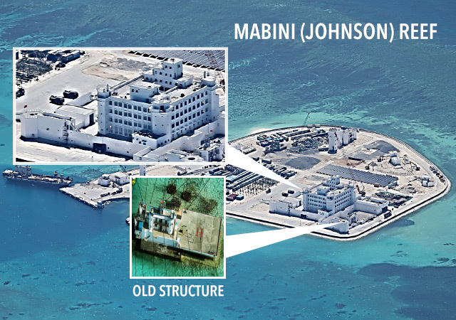
Those islands are huge. How much of Mischief Reef will China reclaim?
Blackstone
Brigadier
Tourism is a good way to show the rocks-turned-islands could produce economic benefits and enables the PRC to argue for some UN recognition.Wow! That's a lot of reefs reclaimed for tourism?
joshuatree
Captain
Tourism is a good way to show the rocks-turned-islands could produce economic benefits and enables the PRC to argue for some UN recognition.
They should use the facilities for aquaculture and coral farming as well. Economic activity that can be sustainable, profitable, and restoring the reefs destroyed from the reclamation. Hard to argue against the facilities if they are used to increase and augment the marine stock.