Chinese UAV/UCAV development

Status
Not open for further replies.

Abominable

Major
Registered Member
Is this an officially affiliated website? If so they seriously need to improve their layout. I've seen better ones from geocities era.

Please, Log in or Register to view URLs content!
Seems to be what it says to me, no single company produces all of those things. I doubt a scam website would be hosted on a CN domain.

It's probably a website given out at arms fairs to prospective buyers.

The design looks like a standard Chinese exporters website. They all use the exact same layout. Easier to navigate if you are familiar with it.

I wonder if they'd be prepared to sell a Rotax 915 clone to a civilian...
 

siegecrossbow

General
Staff member
Super Moderator
Seems to be what it says to me, no single company produces all of those things. I doubt a scam website would be hosted on a CN domain.

It's probably a website given out at arms fairs to prospective buyers.

The design looks like a standard Chinese exporters website. They all use the exact same layout. Easier to navigate if you are familiar with it.

I wonder if they'd be prepared to sell a Rotax 915 clone to a civilian...

Rotax is for civilian use though.
 

Abominable

Major
Registered Member
It's a very obvious fake!!!

How could you all not see such obvious photoshop traces???

They post this pic inside the About Us

Btw who is Qin Renping?
Why would someone take the time to catalogue hundreds (if not thousands) of Chinese military drones on a single website just to pull off a scam? Who exactly would they be scamming, foreign governments? If it was a scammer I'd be impressed with the effort.

Scammers would to stick to fake iPhones/watches where no one would care if people get scammed. They're not asking for payment, it's an enquiry form. I bet if you contacted them they would put you in touch with the relevant manufacturer.
 

by78

General
WingLoong-2 meteorological drone used to study the atmosphere over the Tibetan Plateau. It carries a synthetic aperture radar, a microwave radiometer profiler, and a dozen radiosondes, which it drops from high altitude.

52364230526_d1dd58f74a_k.jpg
52364458683_47f18ad315_k.jpg
52364652935_909ce3802c_k.jpg
 

tankphobia

Senior Member
Registered Member
The Chinese version of Switchblade, the FH901. Superior to the U.S. Switchblade in everyway. Fixed wings that can be folded with a round body. 1.2 meters long, 150KMH top speed. Combat Radius 15KM, Loitering time 120 minutes. Can penetrate 10 cm armor. With 9kg takeoff weight, it can have a warhead that is 3.5 kg. Can be launched on multiple platforms and work as drone swarms.

I wouldn't say strictly better, they serve different roles after all, the fh-901 is basically 3 times heavier than the switchblade 300 if Wikipedia is to be believed. FH-901 looks like it sits right between switchblade 300 and 600 in terms of capabilities, perfectly suited for taking out hardpoints and APCs.

A swarm of those drones guided by aerial AWACS drone such that they can achieve ground hugging flying, then simultaneously impact on all targets would be terrifying and incredibly difficult to defend against kinetically.
 

Strangelove

Colonel
Registered Member
Please, Log in or Register to view URLs content!

China’s large UAV completes first meteorological observation operation in Qinghai-Xizang Plateau

By Global Times Published: Sep 18, 2022 01:20 PM


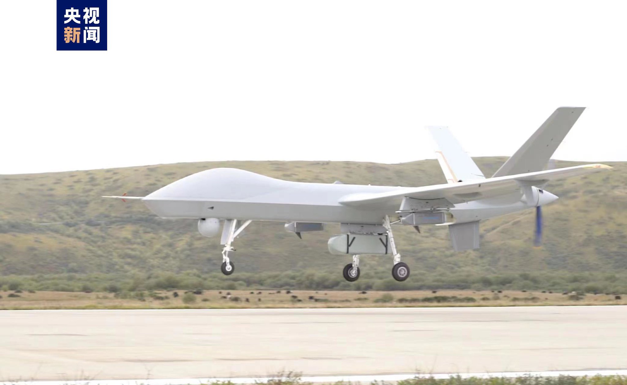
The first test flight of the domestically developed plateau meteorological observation variant of Wing Loong II drone in China's Qinghai-Xizang Plateau was conducted successfully over the weekend, which will provide more data for ecological protection on the plateau and scientific response to climate change.

The deployment of large UAV to the Qinghai-Xizang Plateau is part of projects initiated by the China Meteorological Administration (CMA). This year, the CMA together with other 16 organizations, including the Aviation Industry Corporation of China, used Chinese-made Wing Loong II drone to conduct the observation tests in Southwest China.

The test was carried out in the snow-capped Amne Machin range, located in Sanjiangyuan, which is home to the headwaters of the Yangtze, Yellow and Lancang rivers. During the test, 12 radiosondes were dropped to scan the vertical and underlying surface of the atmosphere over the Qinghai-Xizang Plateau together with the airborne synthetic aperture radar and atmospheric microwave comprehensive profiler.

The successful transmission of a group of observation data including cloud system distribution, water vapor structure, wind field and underlying surface in the source of three rivers to the ground signifies the success of first test flight of the domestically developed high-altitude large-scale UAV plateau meteorological observation in China.

It provides key scientific data for scientifically analyzing the evolution of weather and climate systems and the influence of low-latitude ocean water vapor into China. It is of great significance for China to further improve the accuracy of weather forecast in Southwest China and build the defense line of meteorological disasters.

Xu Xiangde, an academician from the Chinese Academy of Engineering and chief consultant to the experiment, said with the mobile observation of high-altitude large UAVs, a larger vertical observation data of the Qinghai-Xizang Plateau had been obtained, which makes up the shortages of relevant data in the region.

The Qinghai-Xizang Plateau, known as the roof of the world, has a great impact on climate change in China, East Asia and even the world.

The new understanding of the vertical detection of the atmosphere, the 3D structure of the water cycle, and the water supply in the source of three rivers and Xizang's Bomi, known as the hometown of glaciers, will become an important basis for decision-making on water resources and ecological security in the plateau against the background of climate change, Xu said.

After the first drone flight in the Qinghai-Xizang Plateau, the CMA also plans to conduct multiple tests relating to vapor channels, glaciers and regional water supply of the "source of three rivers," in order to build a sky-based observation system with the large UAVs as the main body, providing enriched data for ecological protection on the plateau and a scientific response to climate change.
 
Status
Not open for further replies.
Top