Chinese Satellites, Beidou Navigation System and related technologies

Andy1974

Senior Member
Registered Member
But why can't they just use Beidou or GPS like other car makers instead of launching their own?
That’s a great question. I think part of the answer is to do with the fact that GPS and Beidou are military or used-by-military and hence legitimate targets in a war. Geelys is civilian and commercial and could be spared given the right circumstances.

Perhaps it’s accuracy “on the road” is better than Beidou’s. The mm resolutions is with a lot of ground signal support.

There is also the fact that Geely as a car maker are not in great shape for the battery NEV revolution, so this is a bold and impressive pivot.

Beidou’s revenue is growing very quickly now, and the growth forecast is fantastic, perhaps Geely thinks they can take a percentage of that.

The fact that launch and satellites are getting cheap could mean we see more and more companies/industries putting their own constellations up.

It won’t be long before Huawei starts putting data centers up there.
 

Strangelove

Colonel
Registered Member
Please, Log in or Register to view URLs content!

Beidou makes farming more efficient​


By ZHAO RUIXUE in Jinan and LIU KUN in Wuhan | China Daily | Updated: 2022-06-28 07:51
62ba429fa310fd2bec922fa0.jpeg
A carrier rocket carrying the last satellite of the Beidou Navigation Satellite System (BDS) blasts off from the Xichang Satellite Launch Center in Southwest China's Sichuan province, June 23, 2020. [Photo/Xinhua]

As summer farming work proceeds across China, smart facilities like automated tractors are being widely used, making the work more efficient and reducing labor costs, farmers said.

One of the technologies that back up the smart facilities is the Beidou Navigation Satellite System, China's homegrown system known for its high-precision positioning service.

At a farm in Pingyuan county, Shandong province, farmers at Pingyuan Luwang Agricultural Development Co have been using tractors equipped with the Beidou system to plant soybeans between rows of corn since June 15.

This is the first year that the company tried the combined planting of the two crops, allowing farmers to harvest soybeans without reducing corn yields.

"The Beidou system ensures tractors can lay straight rows at precise distances, which is crucial to the mixed plantings," said He Shibao, who is in charge of the company's plantation work.

He said they had sown 40 hectares in two days with the Beidou-equipped tractors.

In addition to supporting the sowing, the Beidou system is also used with machines including harvesters and drones that spread fertilizers to ensure crops can be taken care of and harvested with machinery.

Nationwide, around 600,000 machines had been equipped with the Beidou system by the end of 2021, according to the Ministry of Agriculture and Rural Affairs.

In Hubei province alone, the Beidou system had been installed on 27,407 farm machines in 3,885 agricultural cooperatives. Tractors, harvesters, rice transplanters, grain dry machines and fertilizer sprayers are guided by Beidou under a national project that subsidizes local farmers who equip their machines with it.

For example, farmers who use the Beidou automated driving system receive a subsidy of 8,000 yuan ($1,195).

At Yongwang Agricultural Machinery Cooperative in Huangpi district, Wuhan, Hubei province, machines have all been equipped with the Beidou system, said Hu Dan, head of the cooperative.

In 2015, the cooperative started using Beidou to survey the area. Now, the Beidou-guided equipment is "used in plowing, removing weeds, harvesting, controlling pests", said Hu.

The Beidou system, integrated with other technologies, such as remote sensing, helps us monitor the whole farming process and provide precise information on each piece of farmland, helping farmers carry out work according to the individual farmland, said Tao Zhe, an operator of smart machines at the Yongwang cooperative.

"We can oversee the farmland conditions on our mobile phones," said Tao, who began working on the farm after graduating from a university last year. Tao is making further studies on the Beidou system.

"Technologies have made our farming work much easier. My parents came to my farm to see the smart machines and they were impressed by the automated tractors," said Tao. "Farm work today is completely different from my parents' time, thanks to modern technologies such as the Beidou system, which enables a lot of the work to be done by machinery."
 

Strangelove

Colonel
Registered Member
Please, Log in or Register to view URLs content!

China upgrades BeiDou software for optimized global services

290ac2f9bcc94636bac2609b69cc8c88.png


An illustration of customers using BDS positioning services. /CFP

It's been two years since China first introduced its self-developed BeiDou Navigation Satellite System (BDS) on July 31, 2020.
The country is constantly upgrading the BDS to provide world-leading services for global customers, with continuous improvement of service system and highlights of technological advantages.

So far, China has
Please, Log in or Register to view URLs content!
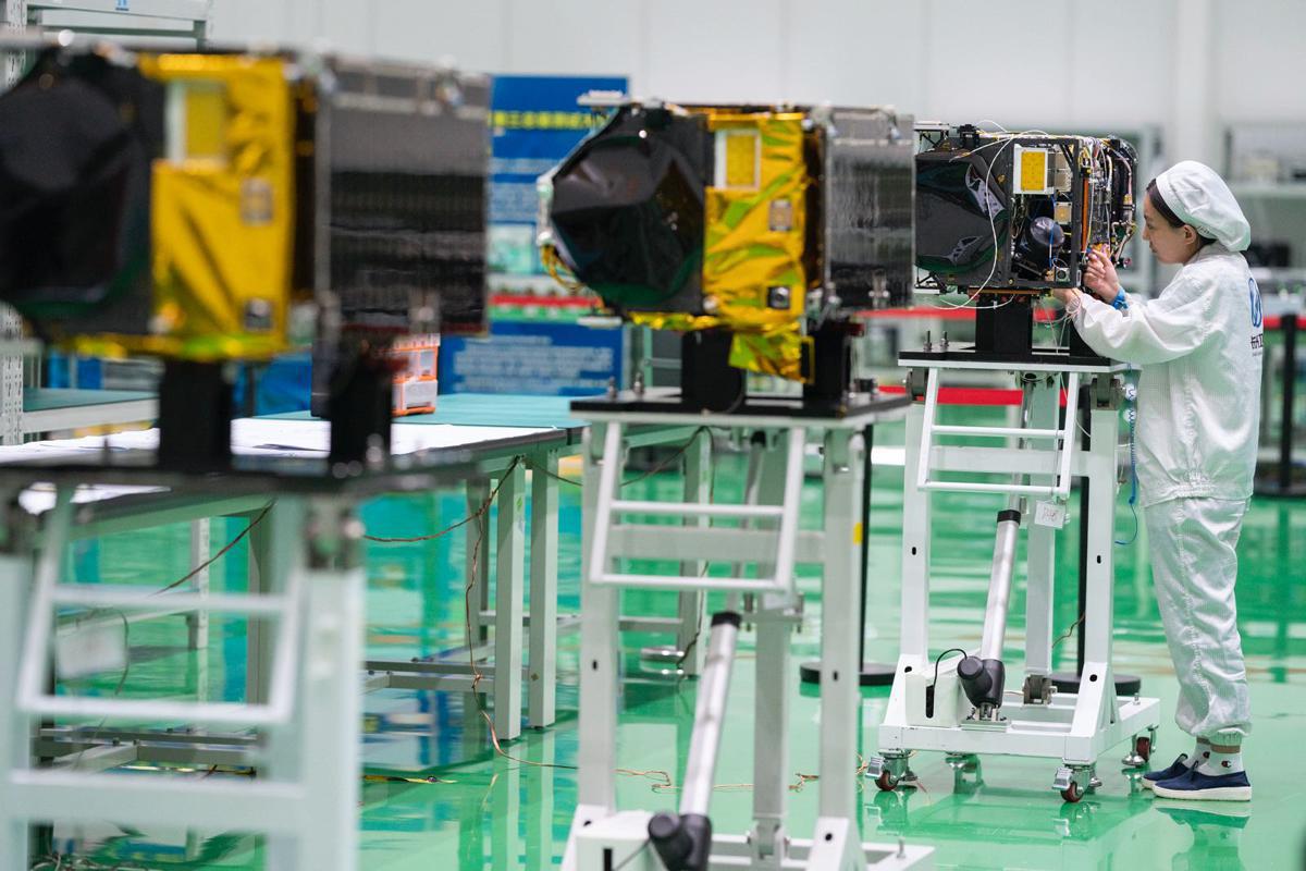
in orbit and the scale of its BDS industrial system exceeded 400 billion yuan ($62.92 billion) by the end of the 13th Five-Year Plan (2016-2020) period. The country completed the construction of its first industrial system of the BDS after 27 years of work, the National Development and Reform Commission announced on April 7.

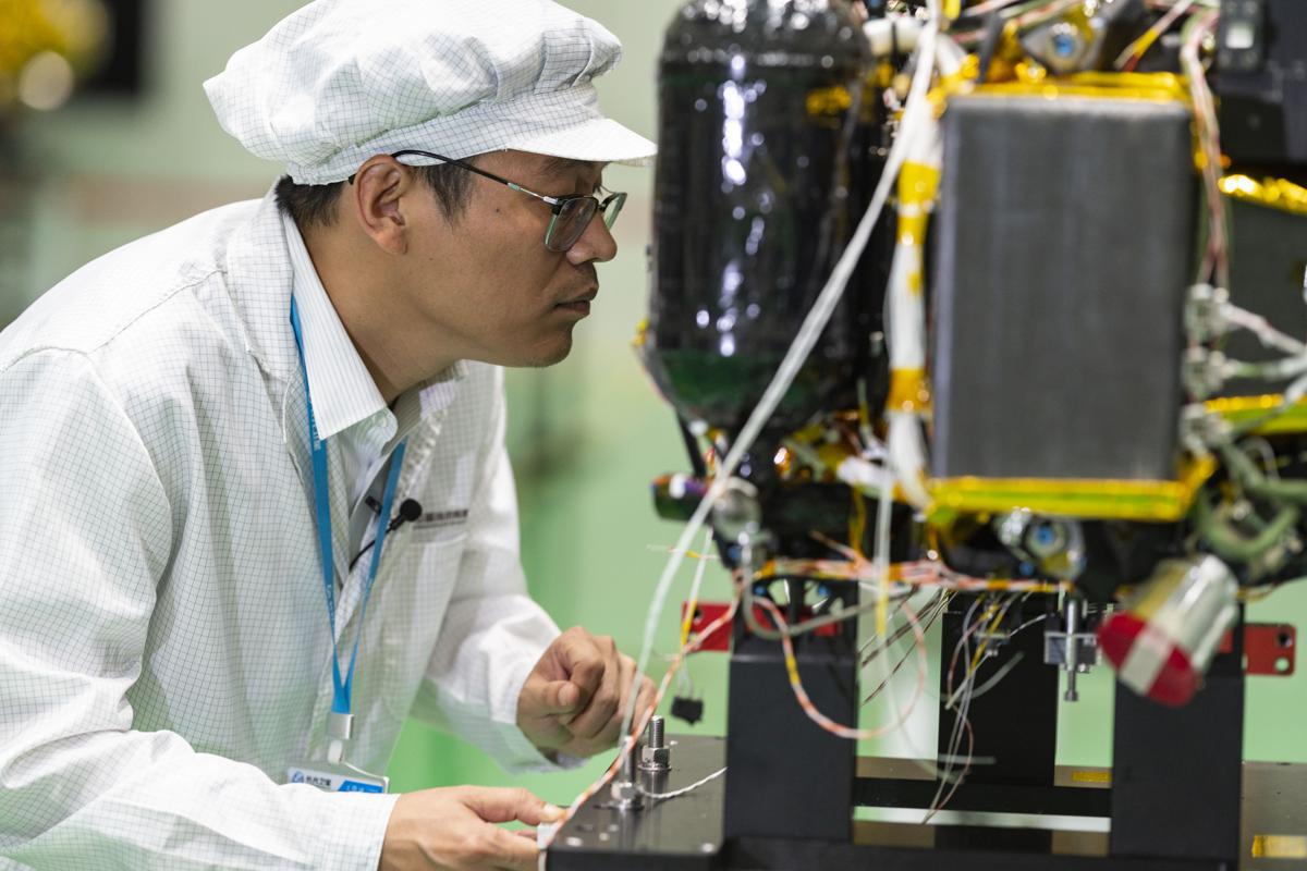
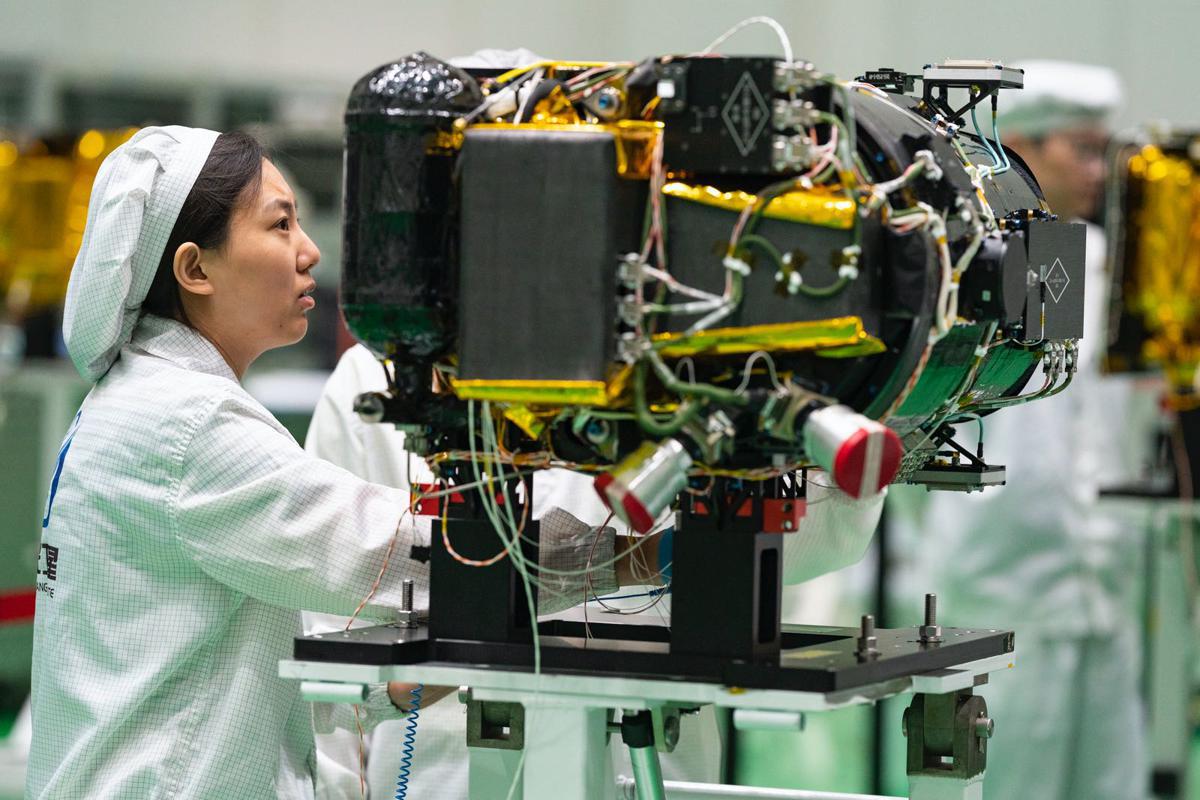
During the latest upgrade of BeiDou in-orbit software, Chinese engineers debugged most satellites commissioned in the system to reduce random system failures, achieve technical escalation, and improve the stable operation of in-orbit satellites as well as their ability of self-correction.

8c867aef234b499ebdc5a1cf60bec0ad.jpeg


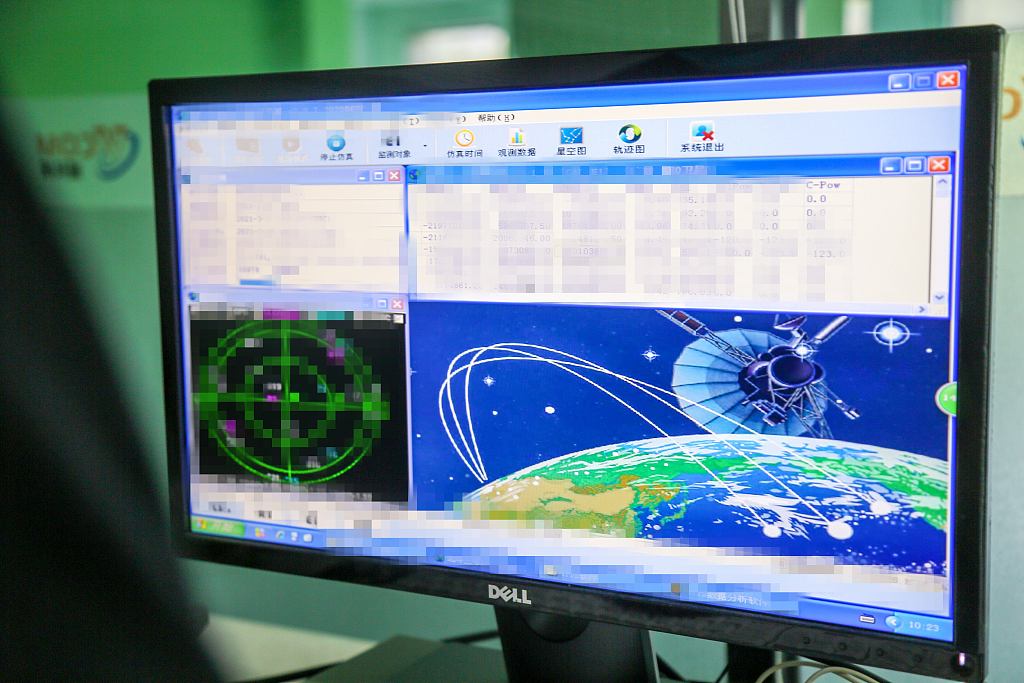
A computer screen shows BeiDou-3 satellite observation data. /CFP

"The software upgrade involves most of the satellites in the whole system, with more than 100 configuration items in total," Li Wenshu, an engineer with Xi'an Satellite Monitor and Control Center responsible for the task, told China Media Group.

"The total amount of tasks is large, the technical state involved in software optimization is complex, the timeliness of upgrade test and verification is limited, and the level of difficulty for implementation is high."

The system upgrade will be finished within three months, according to the engineer.
Meanwhile, the
Please, Log in or Register to view URLs content!
communication services, including new mobile phone functions and satellite-Earth technology solutions, provided by BDS-3 have also progressed from industrial application to public application, according to a conference held in Beijing on July 30.

94aef55ac30e4d6286d60a9ed96d0535.png


China's BeiDou System

The BDS, built and operated solely by China, provides all-time, all-weather and high-accuracy positioning, navigation and timing services to global users.

Driven by the digital economy, BeiDou has been integrated into the infrastructure construction of electric power, agriculture and communication at a faster pace over the past year, according to the white paper.

By the end of 2021, over
Please, Log in or Register to view URLs content!
sets of BeiDou positioning, timing and short message communication terminals had been installed, and more than 7.9 million vehicles had been equipped with the BDS.

Nearly 8,000 sets of BeiDou terminals of various types had been applied in the railway sector and over 100,000 agricultural machines had been equipped with the BeiDou self-driving system to monitor the harvest of staple crops such as rice, wheat and corn and the operation of tractors around the clock.

02692c2d2a174a71b466ee5267c17089.png


A model of BDS positioning services on display. /CFP

Futuristic global services

The BDS is China's
Please, Log in or Register to view URLs content!
space-based system and one of the four global navigation networks alongside the U.S.' GPS, Russia's GLONASS and the European Union's Galileo.

BeiDou-1 serves China's domestic demands and BeiDou-2 covers the Asia-Pacific region with services including regional short message communication, precise point positioning, and satellite-based as well as ground-based augmentation, while BeiDou-3 will provide more services to global customers.

In the coming years, China will further develop public service platforms for BDS application research and development, testing, certification and licensing to optimize the BDS global service system.

The country will advance the BDS's short message and other features to establish a global public emergency service platform for emergency search and rescue as well as distress alarm, providing stable services for all users at home and abroad.

Before
Please, Log in or Register to view URLs content!
, China will complete the construction of a more widely used, integrated and intelligent national comprehensive system of positioning, navigation, and timing (PNT), serving global users with full-coverage and highly reliable PNT services.
 

SanWenYu

Senior Member
Registered Member
Cross-posting of News on China's scientific and technological development.

A CCTV news report discloses some of the performance specs of the BeiDou navigation satellite system.

The system consists of 45 satellites, including 15 gen2 (BeiDou-2) and 30 gen3 (BeiDou-3). The precisions of horizontal and vertical positioning are 1.52 meters and 2.64 meters, respectively. Measurement precision of speed of movement is better than 0.1 meters per second. Time synchronization precision is at 20 nanoseconds or lower.

The satellite system is currently being upgraded live in orbit for newer software. The upgrade will take 3 more months to complete.

今天(7月31日),北斗三号全球卫星导航系统建成开通两周年。在过去的两年中,北斗三号系统运行稳定,已经在全球超120个国家和地区得到应用,向亿级以上用户提供服务。近期,为进一步优化北斗导航系统全球服务性能,确保导航服务更加安全、稳定、可靠,管理团队对北斗卫星系统进行了在轨软件升级工作。

北斗三号全球卫星导航系统,在轨运行服务卫星共45颗,包括15颗北斗二号卫星和30颗北斗三号卫星。当前北斗系统运行连续稳定,全球范围水平定位精度约1.52米,垂直定位精度约2.64米;测速精度优于0.1米/秒,授时精度优于20纳秒。

Please, Log in or Register to view URLs content!
 

Strangelove

Colonel
Registered Member
Please, Log in or Register to view URLs content!

Space tech: In Jilin, they build satellites​


By Han Junhong in Changchun and Zhou Huiying | chinadaily.com.cn | Updated: 2022-08-25 15:30

63072529a310fd2bec9e2494.jpeg
Chen Maosheng works at Changguang Satellite Technology, a State-owned enterprise in Changchun, Jilin province. [Photo provided to chinadaily.com.cn]

Over the past decade, Chen Maosheng and his team have manufactured satellites — a lot of them. They've built 53 Jilin-1 Gaofen-03 satellites, 43 of which have been launched and operated in orbit.

Chen, 37, chief Jilin-1 Gaofen-03 designer, began leading the team to scientific and technological breakthroughs in 2012, when he entered Changguang Satellite Technology, a State-owned enterprise in Changchun, Jilin province.

Pursuing low cost, low weight, low power consumption and high performance, the team broke through several key core technologies and reached an advanced international level.

The satellite family, developed by Changguang, is China's first domestic remote-sensing satellite for commercial purposes. It captures super high-definition images and helps provide forest fire warnings, desertification observations, offshore rescue, ocean protection and other remote-sensing information services.

63072529a310fd2bec9e2496.jpeg
A member of Chen Maosheng's team works at Changguang Satellite Technology, a State-owned enterprise in Changchun, Jilin province. [Photo provided to chinadaily.com.cn]

63072529a310fd2bec9e2498.jpeg
A member of Chen Maosheng's team works at Changguang Satellite Technology, a State-owned enterprise in Changchun, Jilin province. [Photo provided to chinadaily.com.cn]

63072529a310fd2bec9e249a.jpeg
Some members of Chen Maosheng's team work at Changguang Satellite Technology, a State-owned enterprise in Changchun, Jilin province. [Photo provided to chinadaily.com.cn]
 
Top