Chinese Satellites, Beidou Navigation System and related technologies

Strangelove

Colonel
Registered Member
Please, Log in or Register to view URLs content!

China to empower BeiDou global services PNT system by 2035

16c19c3ac52b42aa8a62c93a8c04364e.png

A model of BDS positioning services on display. /CFP

China aims to develop a widely used, integrated and intelligent national comprehensive positioning, navigation and timing (PNT) system based on its self-developed BeiDou Navigation Satellite System (BDS) by 2035, said the China Satellite Navigation Office (CSNO).

Before then, the country will complete the construction of an advanced PNT system, with BDS serving global users with full coverage and highly reliable PNT services, the office said.

In recent years, China has been enhancing the global services of the BDS by continuously improving its service system and highlighting its technological advantages.

Share BDS tech with the world

On July 31, 2020, China officially commissioned the BDS, opening the new BDS-3 system to global users.

Since then, the satellite system has sought to provide quality services by continuously optimizing performance and expanding application modes stably.
Measured by the global continuous monitoring and evaluation system, the BDS-3 system offers advanced global PNT services, with the most outstanding performance seen in the Asia-Pacific region.

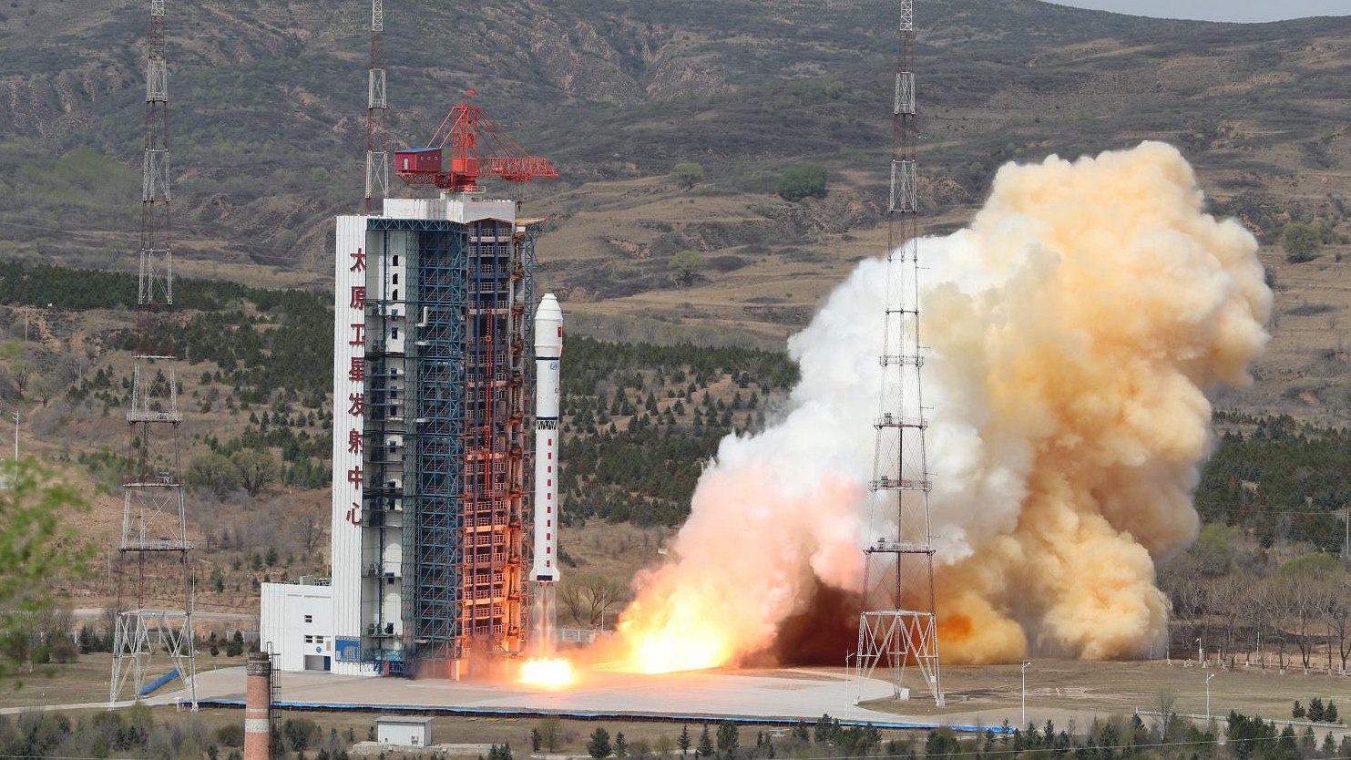
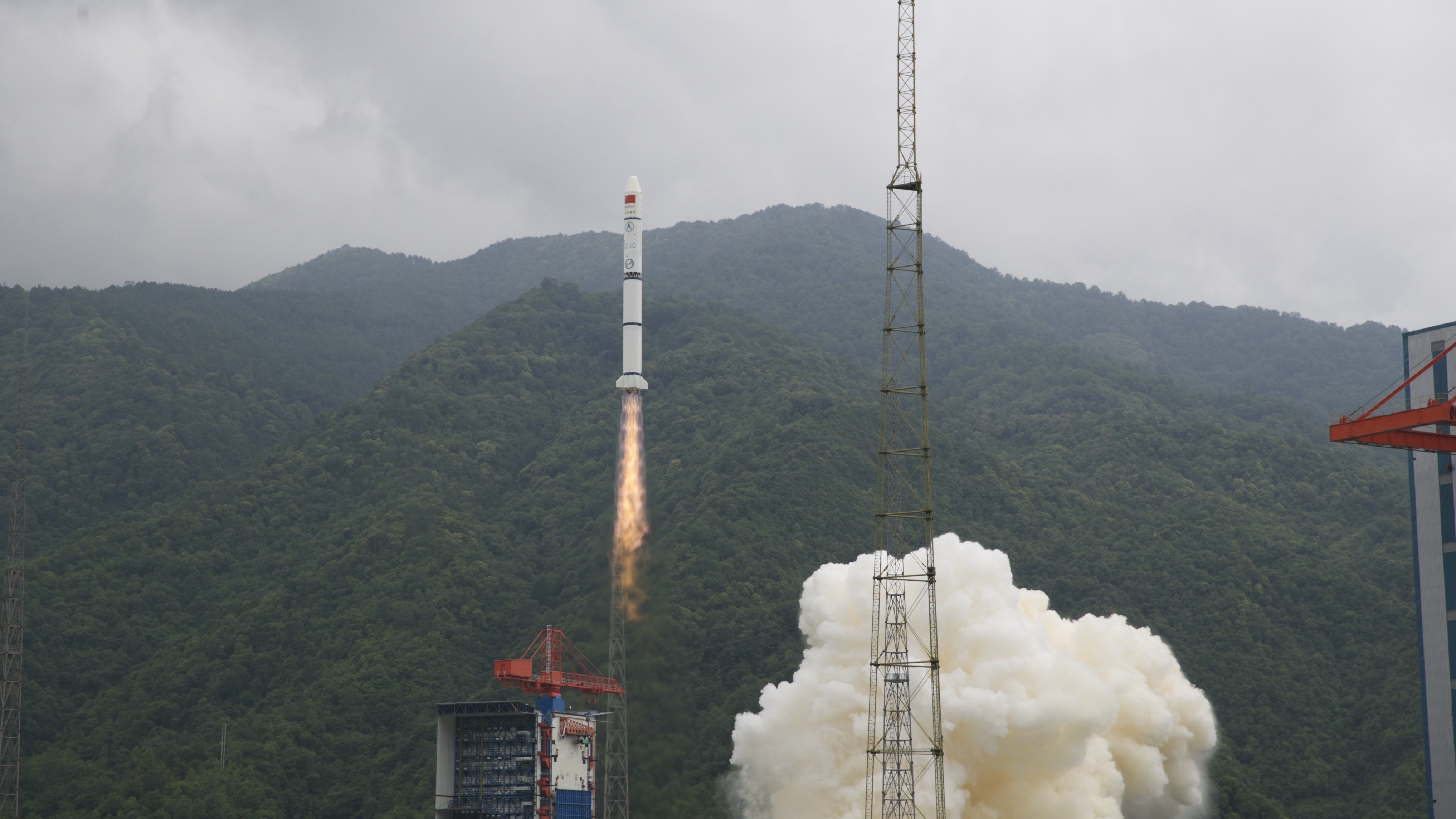
After 27 years of work, China completed construction of its first industrial system of the BeiDou Navigation Satellite System (BDS) on April 7, 2022, the National Development and Reform Commission (NDRC) said.

BDS, built and operated solely by China, provides all-time, all-weather and high-accuracy positioning, navigation and timing services to global users.
So far, the country has 45 BeiDou satellites in orbit, and the scale of its BDS industrial system had exceeded 400 billion yuan ($62.92 billion) by the end of the 13th Five-Year Plan period (2016-2020), according to the NDRC.

China is actively sharing BDS achievements with the world. BDS-related products, technologies and services have been applied in more than half of all countries worldwide, said the CSNO.

The BDS has been contributing to building a community with a shared future for humanity, noted the satellite navigation office.

94aef55ac30e4d6286d60a9ed96d0535.png


Future BDS global services

During the country's 14th Five-Year Plan period (2021-2025), China will endeavor to build the global services system of BDS, according to the NDRC.
The country will enhance the tech competitiveness of BDS, deeply integrate it with other national space infrastructures and ensure that its navigation services and support capabilities compete with advanced level peers globally, the NDRC said.

It will also strengthen the BDS global services support system by building diverse public service platforms for its application research, testing, certification and license issuance, among others.

In addition, the country will also give full play to the short messaging communication and other unique advantages of BDS by establishing a public emergency service platform with global coverage, aiming to provide high-quality services for global users and help with emergency rescue and distress alerts.
 

KYli

Brigadier
Please, Log in or Register to view URLs content!

BeiDou boosts tech support in Chinese smartphone industry​

BEIJING, April 20 (Xinhua) -- China-developed BeiDou Navigation Satellite System (BDS) is boosting the country's mobile phone industry by enhancing product performance.

Mobile phones equipped with the BDS-3 short message communication function will soon be available in the consumer market. It will help expand the application and function of smartphones and effectively ensure the safety of people's lives and property, according to the China Satellite Navigation Office.

This also demonstrates BDS' ability to deeply integrate with a variety of other industries, such as telecommunication, transportation, disaster prevention and mitigation, agriculture, forestry, animal husbandry and power supply.

BDS has achieved a comprehensive breakthrough in mass consumption represented by its extensive application in smartphones and smart wearable devices, according to the National Development and Reform Commission (NDRC).

In 2021, the number of China-made smartphones with BDS application support reached 324 million units, accounting for 94.5 percent of the country's smartphone shipment that very year, showed statistics from the NDRC.

BDS ground-based augmentation messaging has been applied in smartphones, with meter-level positioning capabilities, the NDRC said.

The world's major chip makers, including component providers for smartphones, can provide products that widely support BDS.

In China, BDS has also shown its worth in sustaining key service industries of the country's socioeconomic sphere. By the end of 2021, more than 7.9 million road transport vehicles nationwide had been installed with BDS, and around 8,000 BDS terminals were in use on the country's railway network.

BDS can also serve the medical health, epidemic prevention, remote monitoring and online service sectors nationwide.
 

Strangelove

Colonel
Registered Member
Please, Log in or Register to view URLs content!

China launches first bipolar GNSS-R ocean survey payload

5af26ab0d7c841aab8fb76a2796fefca.jpeg


China launches first satellite-carried bipolar ocean survey payload supported by GNSS-R from the Taiyuan Satellite Launch Center in north China's Shanxi Province, May 5, 2022. /China Media Group

China's first satellite-carried bipolar ocean survey payload supported by GNSS-R, a promising new remote sensing technique, was successfully sent into predetermined orbit, atop satellite Jilin-1 Kuanfu 01C together with seven other Jilin-1 Gaofen 03D satellites launched on Thursday from the Taiyuan Satellite Launch Center in north China's Shanxi Province.

The Kuanfu 01C satellite-carried bipolar GNSS-R ocean survey payload has been mainly developed by Beijing Institute of Applied Meteorology.

It is designed to take the L band signal of the navigation satellite as the transmitting source, and receive and process signals reflected from the ocean, land or moving objects obtained by a device installed on the satellite platform. In these cases, characteristic elements of the media and moving objects monitored by the payload can be extracted.

It can provide important observation data such as the mean sea surface height, wave height, sea ice formation, sea surface wind field and sea salinity for global ocean exploration.

Different from traditional unipolar survey, it can complete the detection and reception of two polarization modes of L band reflected signals simultaneously, and also improve the detection accuracy.

The GNSS-R ocean survey payload can also provide all-weather and all-directional wind information on the sea surface and provide meteorological information for sailing ships.
 

Strangelove

Colonel
Registered Member
Please, Log in or Register to view URLs content!

BeiDou fully serving China's socioeconomic development​

Xinhua | Updated: 2022-05-07 09:29
6275cb73a310fd2bec877e9d.jpeg
Students check out a Beidou Navigation Satellite System demonstration model at a science museum in Jinan, Shandong province. [Photo/Xinhua]

BEIJING -- The China-developed BeiDou Navigation Satellite System (BDS) has been deeply integrated into diverse industries and is fully serving the country's socioeconomic development.

The BDS has shown its enhanced power in driving China's socioeconomic development, with its continuously expanding depth and width of application, according to the China Satellite Navigation Office.

The system is empowering all walks of life through its remarkable achievements. It has been deeply integrated and applied in industries such as transport, disaster prevention and mitigation, agriculture, forestry, animal husbandry and fishing, and power and communication.

By the end of 2021, there were more than 1 billion units and terminals using the BDS positioning function nationwide, according to statistics from the National Development and Reform Commission (NDRC).

In China, the BDS has also shown its worth in sustaining the key services industries of the country's socioeconomic sphere.

By the end of 2021, the BDS had been installed in more than 7.9 million road transport vehicles nationwide, and approximately 8,000 BDS terminals were in use on the country's railway network, the NDRC statistics show.

BDS-based applications are also serving the medical health, COVID-19 prevention, remote monitoring and online services sectors nationwide.


It is estimated that by the end of the 13th Five-Year Plan period (2016-2020), the industrial scale of China's satellite navigation industry exceeded 400 billion yuan ($59.9 billion).

On July 31, 2020, China officially commissioned the BDS, opening the new BDS-3 system to global users.

The BDS can provide diverse services and has powerful functions. Globally, the system can provide positioning, navigation and timing (PNT) services, global messaging communication services, and international search and rescue services.

In the Asia-Pacific region, its services include regional short messaging communication, precise point positioning, satellite-based augmentation and ground-based augmentation.
 

Strangelove

Colonel
Registered Member

Please, Log in or Register to view URLs content!


Atomic clocks put China’s BeiDou satnav system ahead of the rest, study finds​

  • Analysis of data suggests uncertainty was kept to 1 femtosecond a day – equivalent to losing or gaining a second in 30 million years
  • This is something that can affect hypersonic weapons, high-speed communication, transport and even financial services

Please, Log in or Register to view URLs content!
in Beijing Published: 7:09pm, 18 May, 2022 Updated: 7:21pm, 18 May, 2022

A model of China’s BeiDou satellite navigation system, which was completed in 2020. Photo: AP

A model of China’s BeiDou satellite navigation system, which was completed in 2020. Photo: AP

China’s
Please, Log in or Register to view URLs content!
has achieved strong performance in atomic clock stability – something that can affect hypersonic weapons, communications and even financial services – according to a new study.

Scientists in Xian said their analysis of long-term operational data from BeiDou’s hydrogen maser clocks suggested that uncertainty was kept to 1 femtosecond per day – equivalent to losing or gaining a second in 30 million years.

That makes the atomic clocks more stable by an order of magnitude than the rubidium and cesium atomic clocks used in the US global positioning system, GPS, in the same period, according to the team led by Jia Xiaolin, a professor at the Xian Research Institute of Surveying and Mapping in Shaanxi province.

Atomic clocks in the smaller systems, the European Galileo positioning system and Russia’s GLONASS, were less stable than both BeiDou and GPS, the researchers said in a paper published in Chinese peer-reviewed journal Vacuum and Cryogenics on May 5.

Most of the new generation BDS-3 satellites are equipped with hydrogen maser clocks. Photo: Handout


Most of the new generation BDS-3 satellites are equipped with hydrogen maser clocks. Photo: Handout

Satellite positioning works by calculating the time difference in the arrival of radio signals. So clock stability mainly affects users who need to receive positioning signals over a period of time to improve precision and reliability.

Earlier BeiDou satellites were not as precise as the GPS system for more demanding applications because their atomic clocks were less stable, according to Jia, whose institute serves the Central Military Commission’s Joint Staff Department.

The atomic clock is one of the most accurate timepieces available to humans, but the rapid oscillation of atoms in a vacuum environment used for time measurement can be easily disturbed. Mechanical vibration, heat and electromagnetic interference can all affect the behaviour of atoms.

And according to Albert Einstein’s theory of relativity, the mass of the moon, Earth or other celestial bodies can also distort space and time, introducing tiny errors that gradually build up.

Although the atomic clocks in orbit are regularly calibrated by ground controllers, an error of 100 femtoseconds accumulated in a day could cause a precision-strike weapon to miss its target by several metres, according to one estimate by Chinese military researchers.
China has been trying to improve the performance of its BeiDou system since 2017, launching a new generation of satellites known as BDS-3 that are mostly equipped with hydrogen clocks built with cutting-edge technology. Those satellites now make up 70 per cent of the constellation.

For the analysis, Jia and his team looked at the clock performance of the four global positioning systems from August 2020 to July 2021. They used data collected by the German Research Centre for Geosciences.

GLONASS was the most accurate in the span of a second, but its cesium clocks tended to make more errors than clocks in the other systems over time, the paper said.

Galileo also uses hydrogen clocks, some of which performed better than those in the BeiDou system, but with only 20 satellites in orbit the overall stability of the European system was found to be lower than the Chinese one.

The results are similar to the findings of an earlier study by researchers at the National University of Defence Technology in Changsha, Hunan province that analysed a smaller number of satellites.

A separate study by the National Time Service Centre in Xian found that BeiDou’s performance was strong enough to enable China to set up the world’s most accurate timing network. Their research suggested that the network of satellites would mean a military or business user could remain paired to Beijing Standard Time with less than 1 nanosecond of error at any location in the world, which they said was twice the accuracy of GPS.

A precise timing service has an important role in areas ranging from high-speed communication to transport, financial services and military operations.

The Chinese military, for instance, is developing a hypersonic weapon
Please, Log in or Register to view URLs content!
at five times the speed of sound – and the BeiDou system would provide support to achieve that over a long distance.

BeiDou has also made it possible to do things like detecting changes in shape as small as a millimetre at a dam in southwest China as a result of an earthquake over 400km away in Myanmar, according to scientists involved in the project.

The most accurate timing machine ever launched into space was a cold atomic clock on China’s Tiangong-2 space laboratory that should miss 1 second in 42 million years. That is more than four times the stability of Nasa’s most powerful space-based atomic clock, which was launched in 2019 for future deep-space missions and has uncertainty of 1 second in 10 million years.

Last month, defence contractor the Beijing Institute of Radio Metrology and Measurement said it had developed and mass-produced the world’s smallest atomic clock for missiles that is no bigger than a pack of cigarettes.

And researchers at the Chinese Academy of Sciences have said a new-generation space clock is being developed to measure the time with light and reduce the chance of error to 1 second in 30 billion years.
 

ougoah

Brigadier
Registered Member
Beidou is truly a technical masterpiece and one crown jewel in China's tech domain.

I recall learning about some of its details years ago in a GNS class on surveying and commercial SAR technology. Beidou AKA "Compass" came up as a topic one day and we were lucky enough to have someone who worked closely on it talk about some of its technical details. Most of it is public domain but after a comparison of its capabilities and functions, it's clear Beidou is superior to GPS (back then without anywhere near as many number of satellites in its constellation though) and leaves Galileo and Glonass so far in the dust in both technology and number of satellites (this would have been around 10 years ago). These systems are not comparable. China truly did something remarkable with Beidou.

Well I mean China has many other remarkable satellite series doing very different jobs which are no less technically brilliant (and often military and secretive) from common stuff to sometimes where no equivalents exist in the world at the moment - quantum comms, Guanlan, military remote sensing as part of tracking/sensor nodes for certain military applications (you know which ones if you follow leaks and threads closely), breakthrough telecomm experimental satellites "6G". Beidou is easily the most commercially and industrially useful. It's also the most capable GNS in the world even after GPS' overhaul and new constellations. It was so important for Beidou to have beaten Galileo to right to transmit in its specific frequency bands. This is one major advantage because those frequency bands offer certain advantages I could not understand despite it being explained (I'm not an EE and Ohm's Law is about all I remember from 1st year physics). Some other inherent advantages are in its use of GEO rather than MEO that other GNS constellations use.

Of course once we go into details on its unique (before GPS upgrade) ability to receive and transmit with superior communication with receivers on the ground where units on the ground can directly communicate with the satellite. Latest generation atomic clocks and I'm sure many more advances with Beidou 3. 15 years ago, this stuff was groundbreaking and had no equivalents. Well Glonass and Galileo still don't offer receiver direct communication with satellite.

Galileo constellation has less than half Beidou's to the point older Beidous have been retired and put out of orbit. Galileo project really dragged on to the point even China's hedge on investing in Galileo turned out to be rather pointless. Glonass is technically weaker but at least offers some better coverage than Galileo. Glonass is rather old now so the weak techniques are understandable. While more than 20 Beidou satellites of the first generation have been retired, Galileo has barely retired a handful and have throughout its program been delayed again and again that it's only in its first generation while Beidou is entering its third generation. To think there was total dependence on China's investment in Galileo barely 20 years ago for GNS and back then the hedge was Glonass.
 

ougoah

Brigadier
Registered Member
Come to really think of it, Desert Storm was a wake up call for military planners and the entire world got to see GPS in action.

China put space technologies in its list of high technology since the mid to late 20th century (in comparison aviation was only added to that list decades later!) where technologies within the list are considered major priorities for the nation.

1990s allowed Chinese military to re-evaluate Soviet thinking and regear. One way or another China wanted its own GNS system as so much of a modern technology dominated military is entirely dependent on it. No country outside of China, USA, and Russia can wage technological war on another without the blessing of whoever owns the GNS that so much of their inventory relies on even if just for navigation. Inertial navigation can't be used for everything after all.

Having always had GNS and various space programs on its to do list, there's no surprise that by the 2000s Chinese GNS technology was developed and ready for its first gen deployment.

There's another reason why Beidou satellites are far further deep in space than other GNS constellations.
 

Strangelove

Colonel
Registered Member
Please, Log in or Register to view URLs content!

China's satellite navigation industry growing exponentially​


By Zhao Shiyue | chinadaily.com.cn | Updated: 2022-05-20 14:36

China's satellite navigation and location-based services industry witnessed robust growth in 2021, with the gross output reaching 469 billion yuan ($69.6 billion), a year-on-year increase of 16.29 percent, according to a white paper released Wednesday by GNSS&LBS Association of China.

It's also worth noting that the output value of high precision-related market in China surged from 1.1 billion in 2010 to 15.19 billion yuan in 2021, a compound annual growth rate of 24.5 percent.

High-precision technologies have wide applications in various areas. For example, the chips can be used in drone and robots, autonomous driving, smart construction and intelligence-connected vehicles.

As the white paper showed, the total sales volume of various high-precision application terminals registered about 1.7 million units in China by 2021.

BeiDou, China's homegrown navigation satellite system, is well known for its high-precision positioning service, with accuracy at the millimeter level for smart devices. In comparison, that of the ordinary satellite is around 10 meters.

According Qianxun SI, the operator for Beidou Foundation Reinforcement system, as of March this year, the positioning service of Beidou had been used more than 100 billion times every month, serving over 1.1 billion people across the globe, covering over 230 countries and regions.

Nowadays, the shipment of smartphones that support Qianxun high-precision positioning for driving lanes has exceeded 20 million units, with more than 10 of the latest models included, such as Huawei, Honor, Xiaomi and Vivo.
 

Strangelove

Colonel
Registered Member
Please, Log in or Register to view URLs content!


China sends 9 satellites into orbit for intelligent connected vehicles

Updated 18:01, 02-Jun-2022


5828967b0b82460a904ac76b499ff133.jpeg


China successfully sent nine satellites into orbit aboard a Long March-2C rocket on Thursday from Xichang Satellite Launch Center in southwest China's Sichuan Province.

The Geely-01 constellation consisting of nine satellites lifted off at 12:00 p.m. Beijing Time and entered the preset orbit.

The satellites constellation will serve the future travel services of intelligent connected vehicles and mobile phone-satellite interaction. It will also provide data support for marine environmental protection.

The constellation is owned by GeeSpace, a subsidiary of Geely Technology Group.

This is the fourth launch of the Long March 2C rocket series this year, which is developed by China Academy of Launch Vehicle Technology. The launch has also set a new record of Long March-2C rocket with the most satellites in a single mission.

This was the 422nd flight mission of the Long March rocket series.

FUOodabUUAEbKgC.jpg
 
Top