
You are using an out of date browser. It may not display this or other websites correctly.
You should upgrade or use an alternative browser.
You should upgrade or use an alternative browser.
China's Space Program Thread II
- Thread starter Blitzo
- Start date

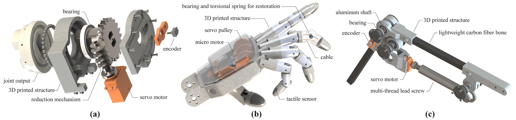
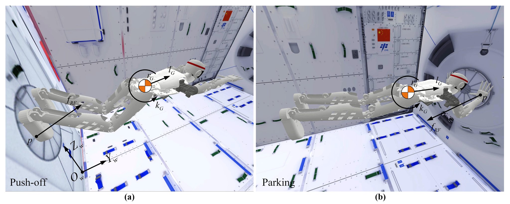
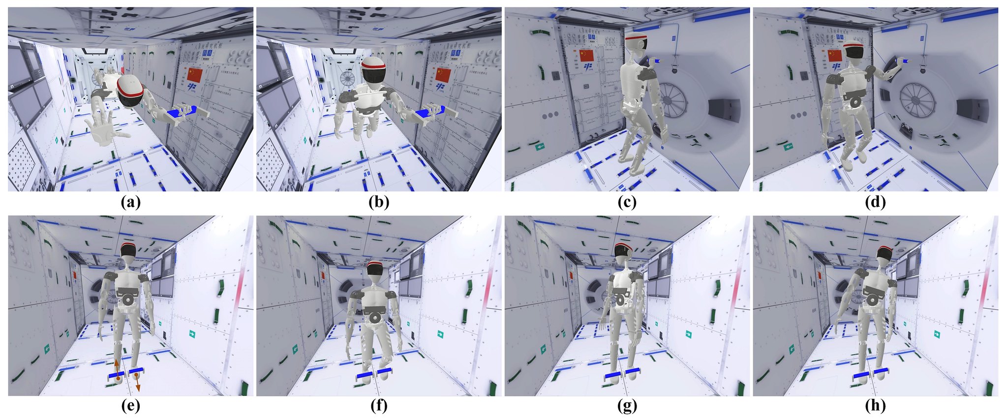
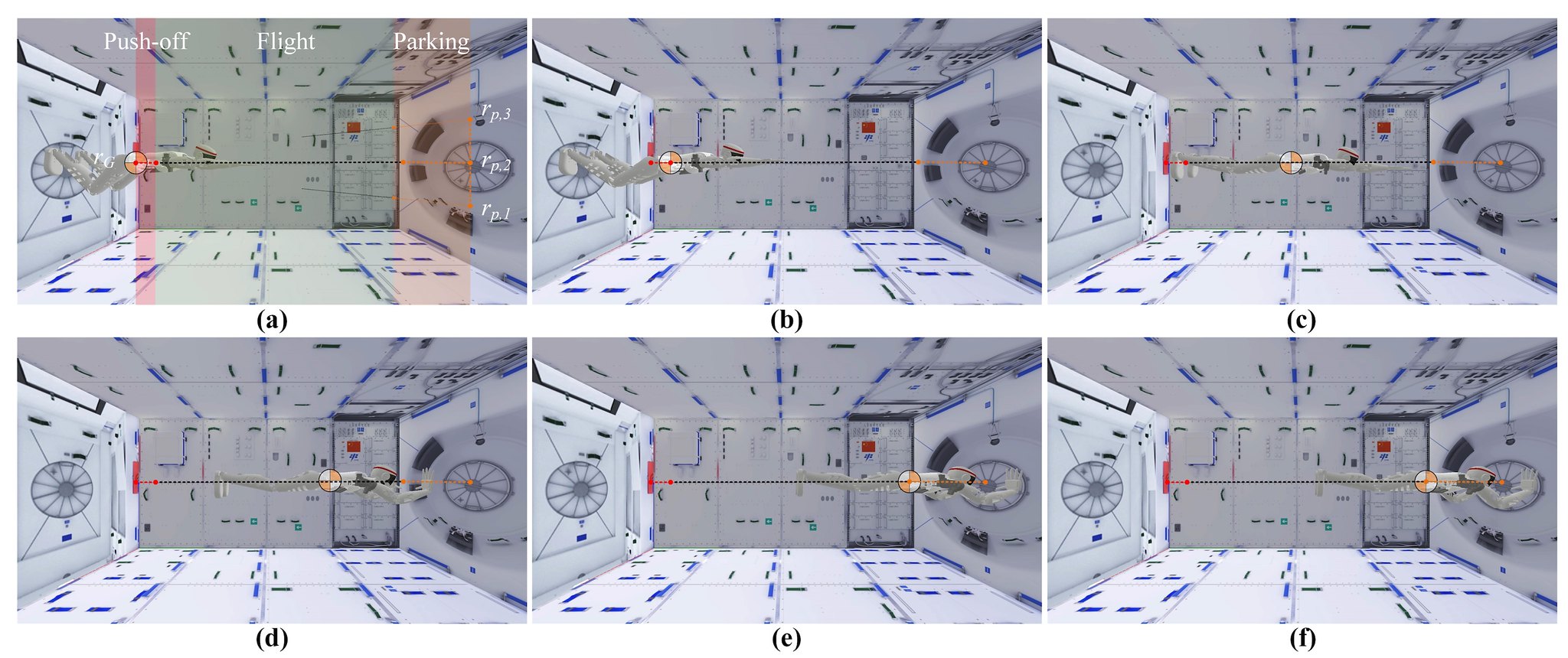


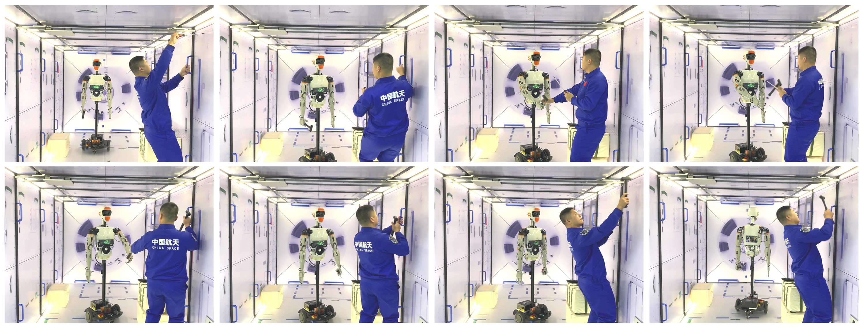
You see a cool robot helper for China's space program.
I see a cool new character for Wandering Earth 3.
We are not the same.
I wonder if the robot could be used for EVA as well, removing the need for manned EVA?
Maybe the same 5G tech used for remote surgery could be used to control the robot during EVAs?
by78
General
Not Tengyun Project, which is a project under CASIC. This paper was published by employee from CASC instead, so a parallel development.
Thanks. Do you have access to the paper? I'd like a copy if possible.
Unfortunately no, I would have posted it yesterday if I had the paper.Thanks. Do you have access to the paper? I'd like a copy if possible.
It is behind cnki paywall.
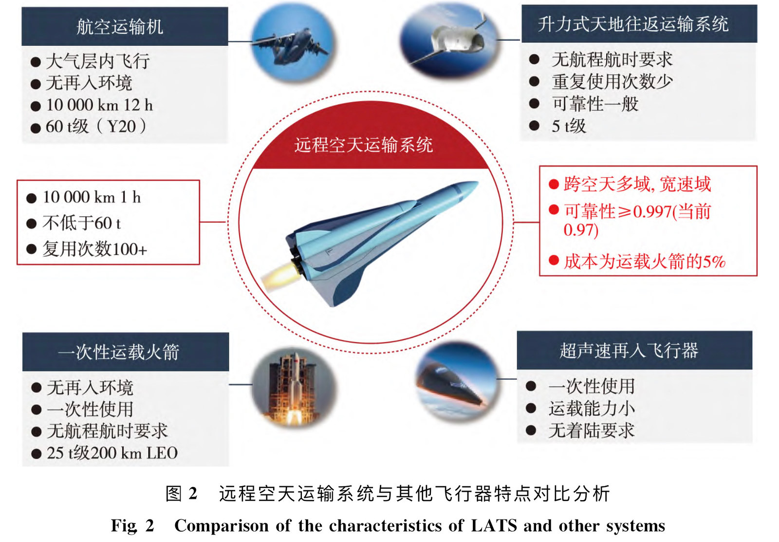
Depends on what is Tengyun project's definition. The particular LATS is NOT orbital launcher, the 2nd stage does not reach orbital velocity but rather a glider. It is same in principle to DF-17 but with much longer range that its 1st stage will leave atmosphere. It is essentially the longer ranged boost-glide craft in the book "高速远程精确打击飞行器方案设计方法与应用"Illustrations from paper on a HTHL spaceplane/transport plane. Might this be about the Tengyun project? Does anyone have access to the paper to provide more context?
Some specs based on the illustrations:
- Re-usability: >100 times
- Payload capacity: >60 tons
- Reliability: <0.997 (target goal), 0.97 (achieved)
- Speed: ≥10,000km
- Cost per launch: ~5% of single-use rockets
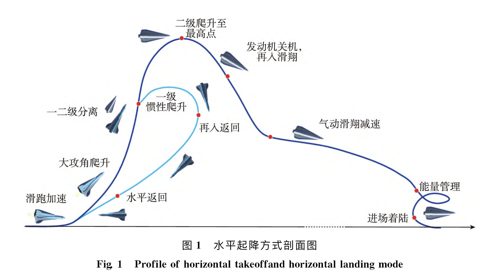
The blue circled profiles are DF-17 at around 2500km range, the orange colored is 11000km range which is LATS range. The peek altitude is the 2nd stage or glider at 138km which is outside of atmosphere.

[Edited]
This part of figure 2 in your post is an orbital launcher (as comparison to LATS). This could be Tengyun. Or Tengyun could be the overall program that include LATS.

So the question is, what exactly is Tengyun?
Also, this part of fig 2 is not appropriate comparison because LATS is not able to put anything in orbit while a Rocket does.

Last edited:
by78
General
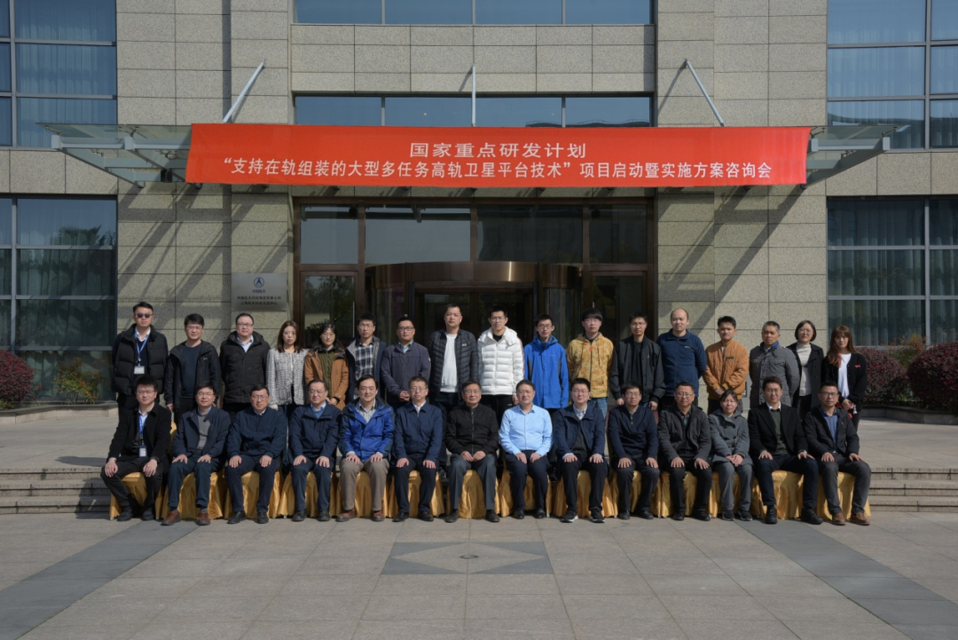
A key R&D project under the 14th Five-Year Plan has been launched. The project aims to develop a very large satellite platform for mounting various sensor packages for earth observation. Current observation satellites are generally dedicated to observing a single aspect of Earth (such as atmospheric humidity, temperature, winds, topography, etc.), which makes combining the separate streams of data very difficult. The project aims to bundle multiple sensors packages onto a single platform to enable persistent, coordinated observation of geophysical evolution, with high temporal and spatial resolution. The project will be led by the Eighth Academy of CASC, with the 509th Institute responsible for the overall technological development and implementation.


by78
General
(Continued from above...)
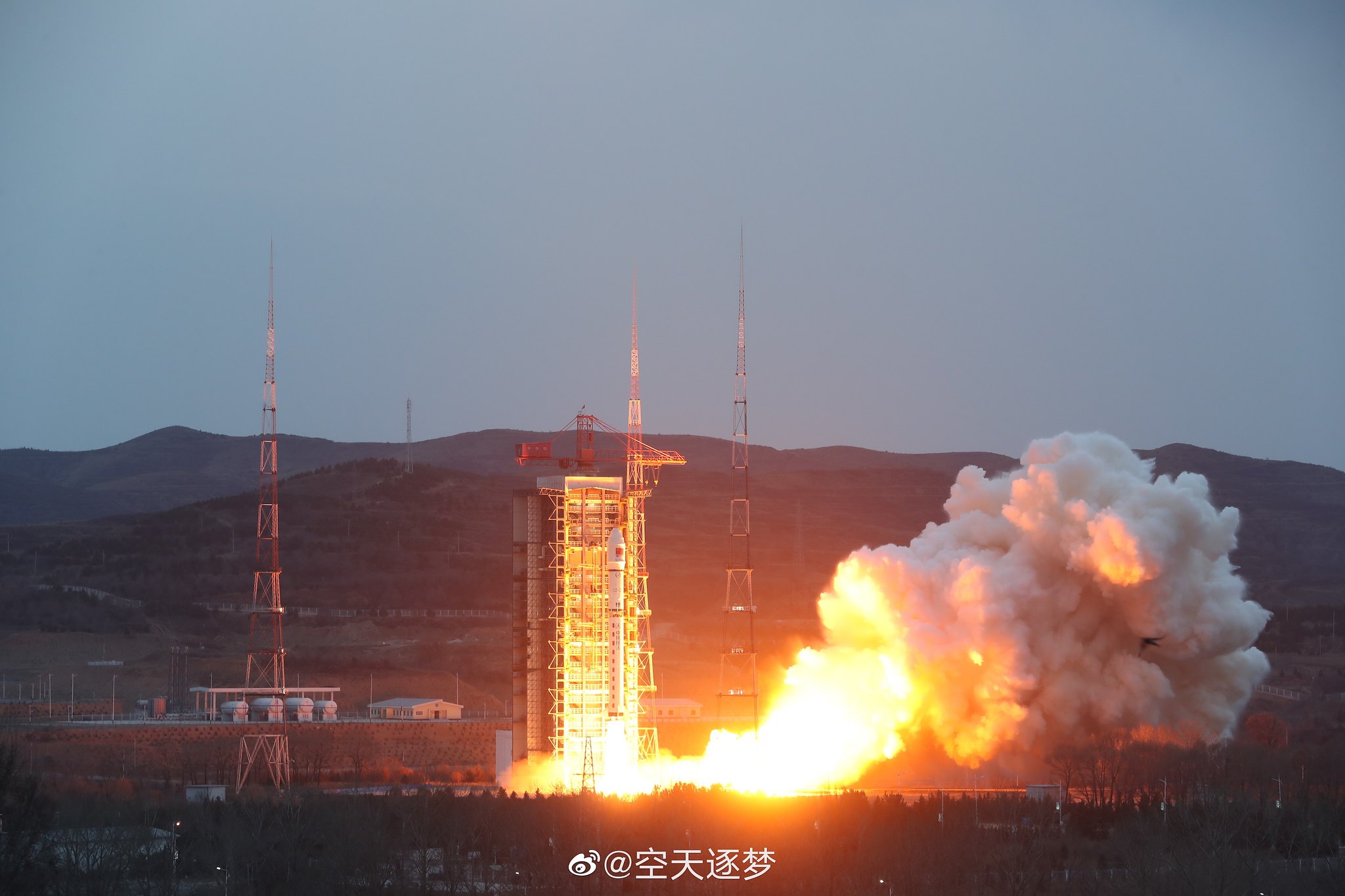
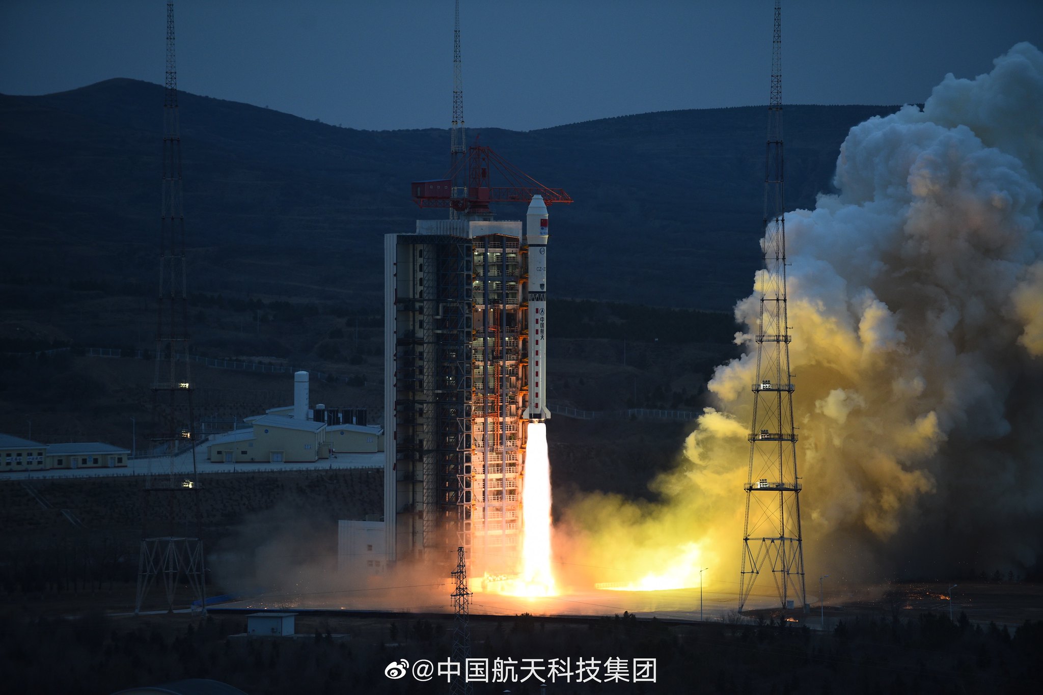
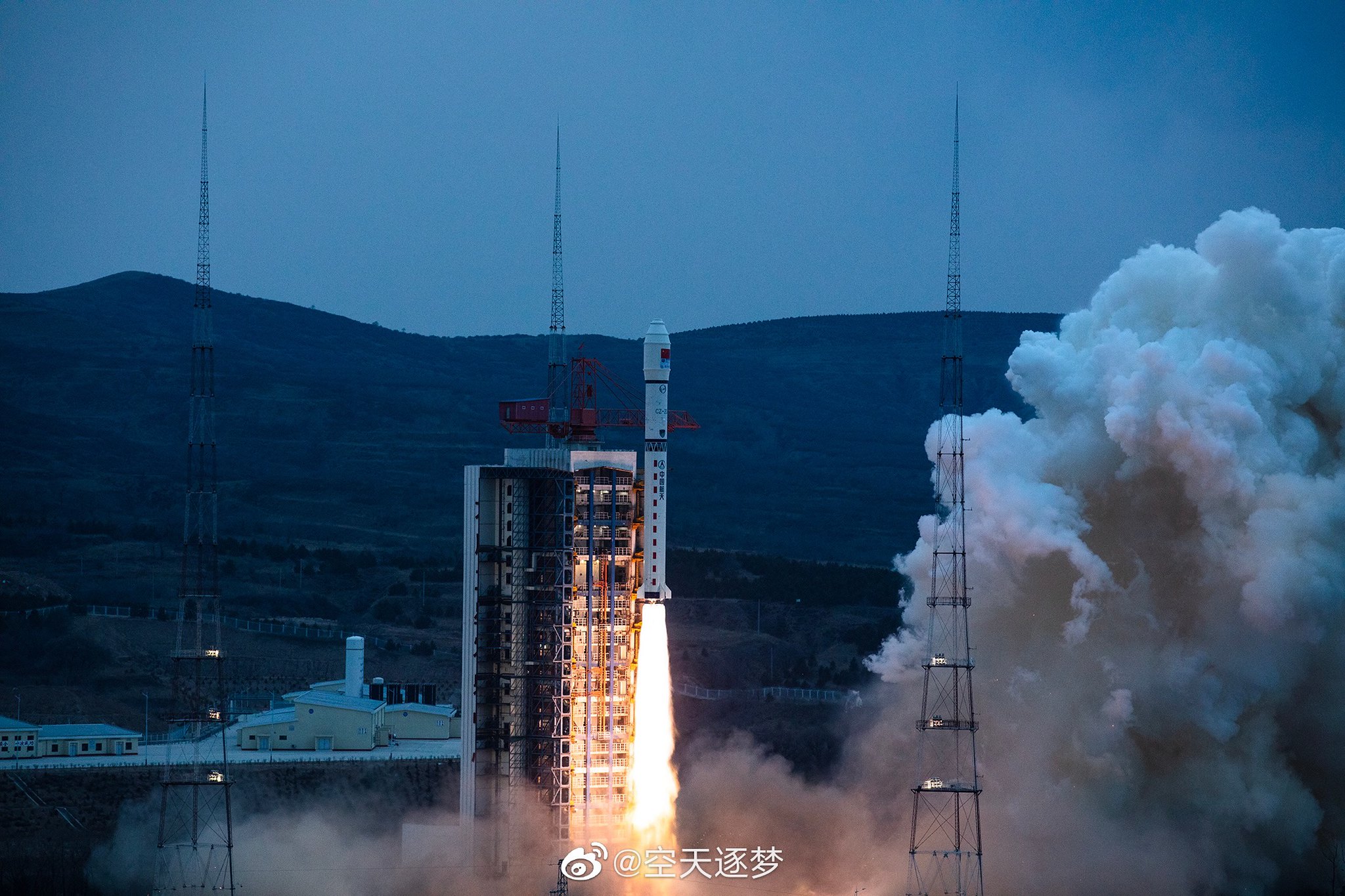
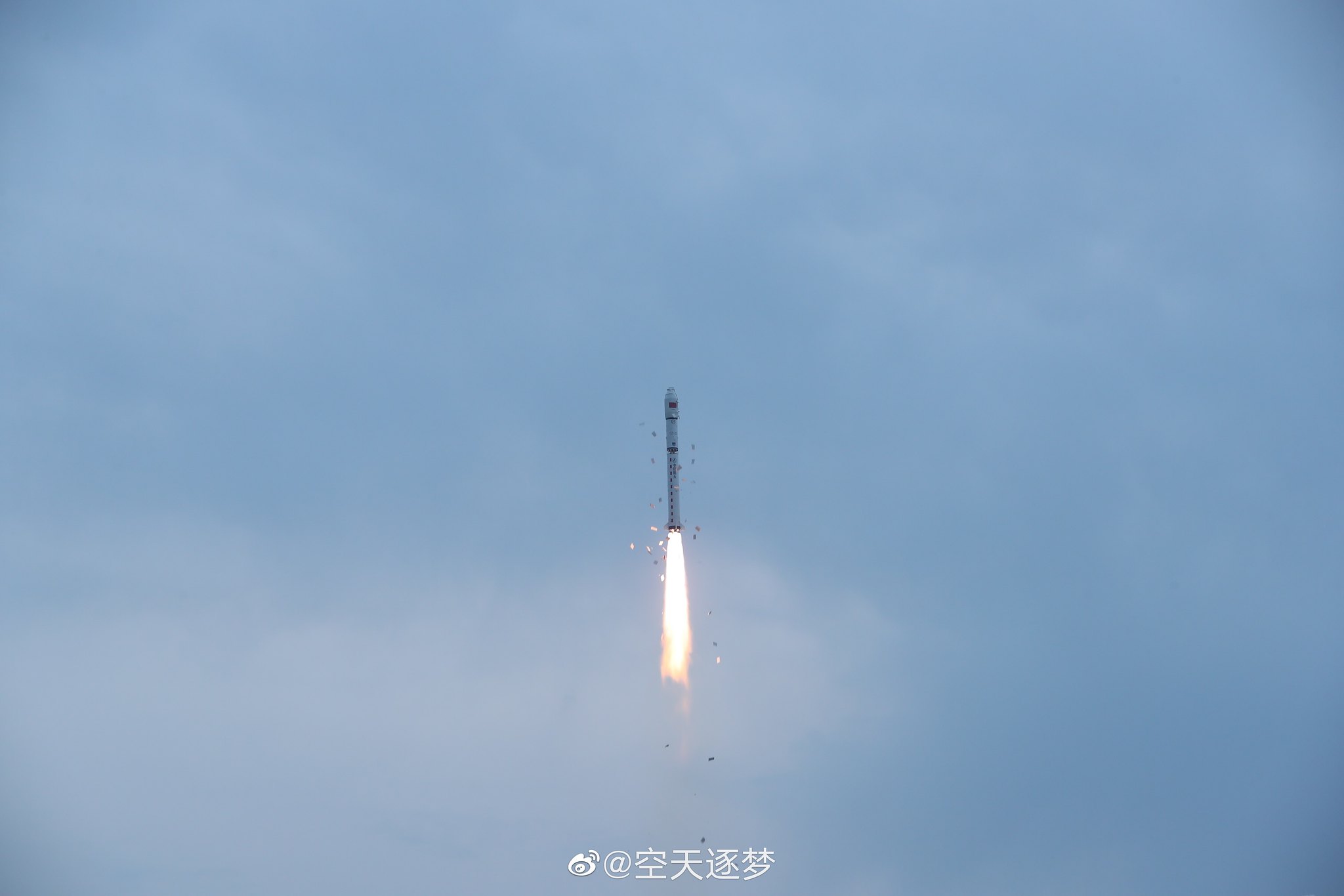
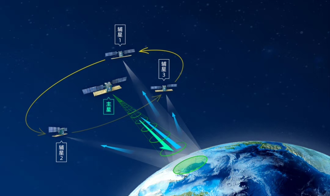
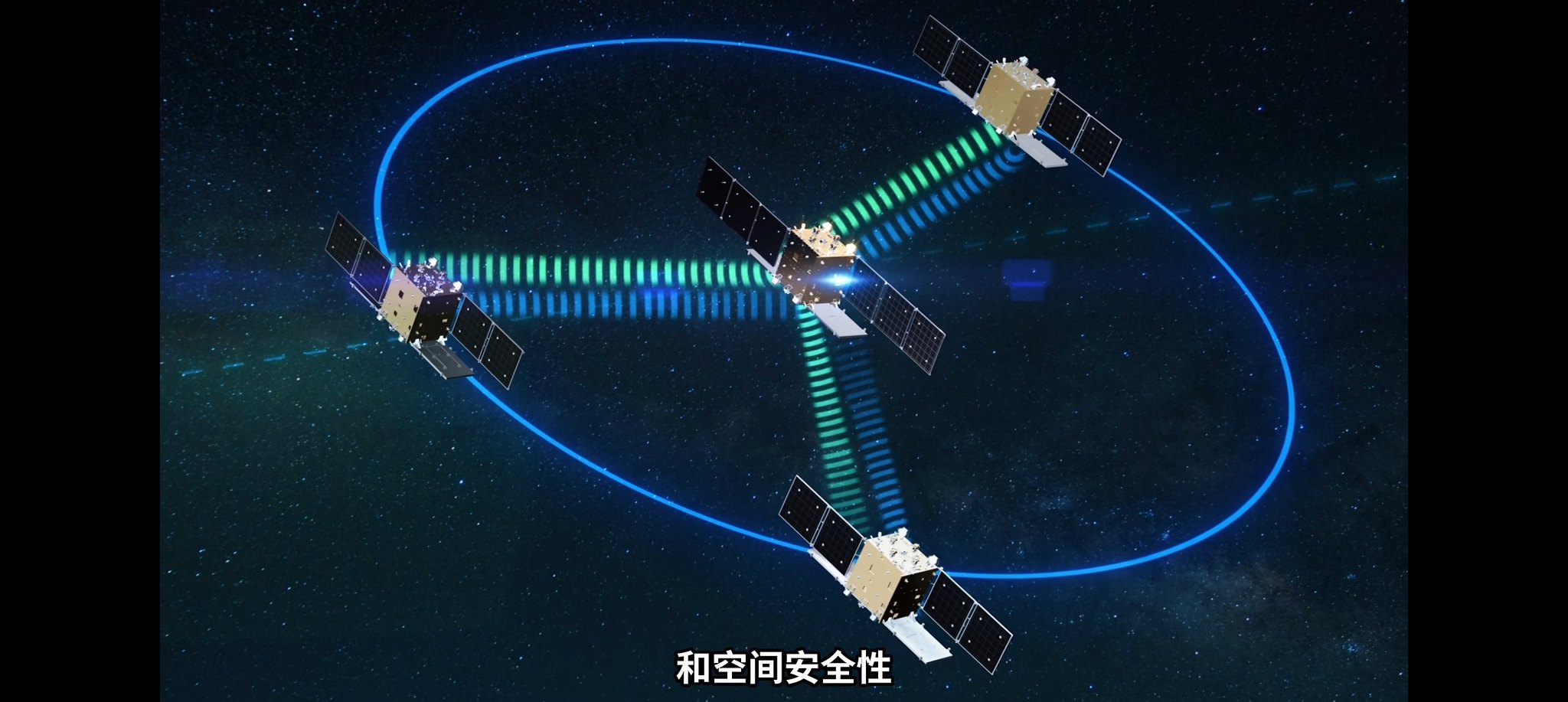
More on the four Hongtu-1 (宏图一号) satellites mentioned in the post above.
The four satellites are X-band interferometric SAR (InSAR) remote-sensing satellites. In a world's first for InSAR satellites, they will be orbiting the Earth in a hub-and-spoke formation, in which three daughter satellites are distributed around the mother satellite at a distance of only a few hundred meters. The formation has the ability to survey non-polar regions at a scale of 1:50000, with sub-meter imaging resolution.
These four satellites are part of the Nuwa (女娲) constellation, which is planned to grow to 38 satellites (28 radar + 10 optical). More on the Nuwa constellation in the next post.
by78
General
(Continued from above...)
The Nuwa (女娲) constellation of 38 remote-sensing satellites is being developed by . Once the constellation is finished, it will be capable of mapping the planet every 24 hours, with revisit period of one hour.
The constellation will be constructed in three phases.
Phase I: Launching the Hongtu-1 batch of four InSAR satellites, which has just been completed earlier today.
Phase II: Launching a further 16 SAR satellites, with four being C-band and 12 being X-band.
Phase III: Launching the final 18 satellites, with eight more C-band SAR satellites and 10 optical satellites with a resolution better than 0.5m.