China's Space Program News Thread

Status
Not open for further replies.

escobar

Brigadier
Please, Log in or Register to view URLs content!


Chang’e-2 satellite successfully crossed the threshold of 10 million kilometers of flight in its deep space exploration under the precision control of the Beijing Aerospace Control Center (BACC) at 23:46 on January 5, 2012, a new landmark in China’s deep space exploration.

Compared to the Chang’e-1 satellite which flew for 380,000 kilometers, Chang’e-2’s breakthrough of 10 million kilometers in its prolonged service for almost two years has been so far the farthest distance that the Chinese spacecraft has ever achieved.

According to Zhou Jianliang, chief engineer of the BACC, Chang’e-2 became the first satellite in the world to take off under the precision control of the BACC from the lunar orbit to enter the Sun-Earth Lagrange L2 point about 1.5 million kilometers away from the Earth and conduct a close-range probe into the Toutatis asteroid 7 million kilometers from the Earth.

Chang’e-2 has also achieved fruitful results in terms of the optimized analysis and usage of fuel, the study of orbital decay law, and so on, having thus laid down a solid foundation for China’s follow-up space flight projects, including the implementation of manned spacecraft as well as lunar exploration.
 

escobar

Brigadier
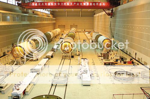
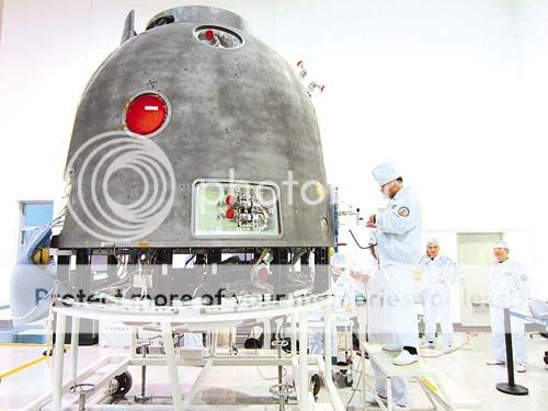
LM-7 engines first parallel test..

Free_20130107194446780_zpsd7deedad.jpg

Free_20130107194511687_zpsd5c24d6a.jpg
 
Last edited:

escobar

Brigadier
Please, Log in or Register to view URLs content!


A review of the current USSTRATCOM TLEs revealed that the formation reformed on or about Dec 25th, 2012 after at least two coordinated maneuvers by the (A) and (B) objects. These maneuvers were followed up by the (C) object as it maneuvered a number of times to match the mean motion of the other two. This behaviour was somewhat different than the commissioning sequence of Yaogan 9 which only maneuvered the 'drifting' s/c to finalize the commissioning sequence.
The Mean Motion of the formation appears to match that of Yaogan 9 suggesting coordinated use as is suspected by US NOSS...
 

escobar

Brigadier
BDS used in a rescue exercise...

[video=youtube;kZTMsQvk2Xo]http://www.youtube.com/watch?v=kZTMsQvk2Xo[/video]
 

escobar

Brigadier
Please, Log in or Register to view URLs content!


China's first high-resolution, stereo mapping satellite Ziyuan III meets international standards, ridding the country of its reliance on imports of satellite images.

It was announced at a seminar reviewing the research and development of Ziyuan III held on Wednesday, one year after the satellite was launched.

China used to import over 90 percent of its remote-sensing data, according to the seminar.

The launch of Ziyuan III has enhanced the country's capability to capture space remote-sensing images, bolstered state security and boosted the geo-information industry.

Also according to the seminar, China plans to build a remote-sensing mapping satellite system in 10 to 15 years. Three follow-up mapping satellites are already in the pipeline.


The Ziyuan III 02 satellite is likely to be launched in early 2014, allowing the two orbiters to form a network, so that real-time data on any given point on earth can be retrieved throughout the day.

The satellite, a high-resolution remote-sensing satellite for civilian use, was launched on Jan. 9, 2012. It is expected to compete with its foreign counterparts that currently dominate the country's hi-res remote-sensing and mapping market.

The satellite is tasked with offering services to aid the country's land-resources surveys, natural-disaster prevention, agricultural development, water-resources management and urban planning.

It has a designed life expectancy of five years.
 
Last edited:
Status
Not open for further replies.
Top