asif iqbal
Banned Idiot
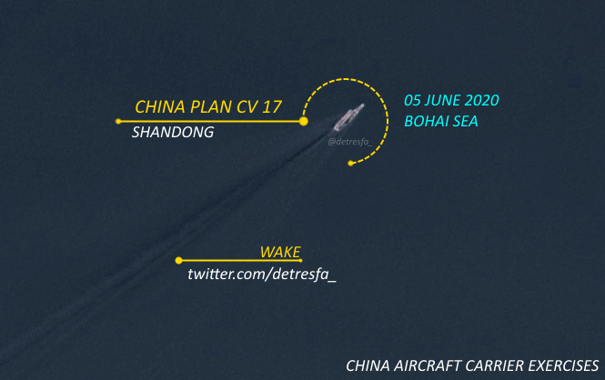
for a second I thought this was CV-16 and CV-17 in same photo!! ")


I've come to the conclusion those licence plate claims are hyperboles. The best military grade resolution is estimated around 10 cm as you mention, and the best resolution I've come across for a commercial satellite is quoted at 25 cm. Greater resolution than that really requires huge mirrors, there's no magic electronic shortcut. And so far no one saw it worth the effort - to launch a 50% or 100% wider satellite that the biggest military recon satellites of today. It's just not that practical.Sorry for the off topic, but a quick question about satellite imagery resolution. I remember hearing claims that military recon satellites can read license plates and even determine the number of paint layers on a vehicle from space. This always sounded like BS fanboi dreams to me. From what I later read, the best current commercial satellites have a resolution of 30 cm and the best military satellites are about 10 cm. Neither of which is good enough to read a license plate, nevermind paint layers (unless that's done using sensors operating in a different band of the EO spectrum). My question is do those aforementioned claims have any basis in reality?