Miragedriver
Brigadier
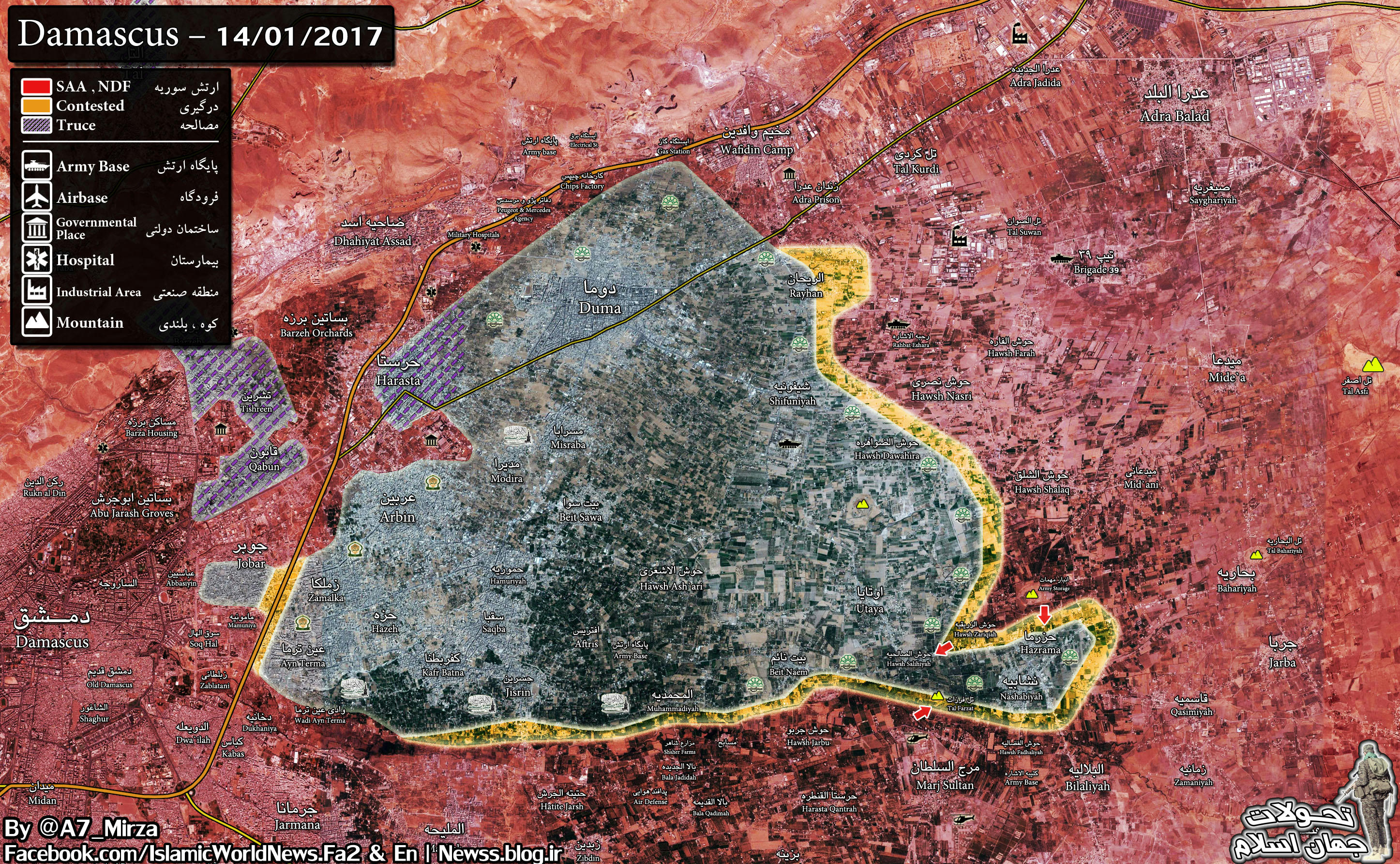
Tanks with GoPro's™ Attack Encircled Rebels in Jobar Syria - subtitles
So who did it?US denies carrying out Syria mosque air strike near Aleppo which killed at least 42 people
US Central Command says it carried out strike targeting al-Qaeda militants nearby but did not targeting house of worship
At least 42 people - most of them civilians - have been killed and dozens more injured after warplanes struck a mosque in rebel-held Aleppo province during prayer time, war monitors have reported.
- Beirut 4 hours ago
More than 300 people were gathered for evening prayers on Thursday at Umar ibn Al-Khaṭṭab mosque in the village of al-Jina when the attack occurred, the UK based Syrian Observatory for Human Rights said.
Estimates vary as to how many died. The volunteer Syrian Civil Defence rescue service said dozens of people remain buried under rubble.
US Central Command has denied that coalition jets deliberately hit the mosque, but said that strikes on Thursday targeted an al-Qaeda meeting location in Idlib. A later statement clarified that it was not clear where the strikes had taken place, and made no mention of civilian casualties.
“We did not target a mosque, but the building that we did target - which was where the meeting [of militants] took place - is about 50ft (15m) from a mosque that is still standing,” spokesperson Colonel John J Thomas said.
Photos shared by activists reportedly from the scene showed bomb debris carrying serial numbers which identified the weapons used as American made Hellfire missiles.
The Syrian and Russian air forces also carry out frequent strikes in and provinces against both Western-backed and al-Qaeda linked rebel forces.
Al-Jina, just west of Aleppo, is located firmly within rebel territory.
Its population has been swollen by internally displaced refugees since east Aleppo fell back under government control in December 2016, when under an amnesty deal its inhabitants were bussed out to surrounding rebel towns and villages.
The civil war - which has just entered its seventh year - has left almost half a million people dead and sparked the world's worst refugee crisis since WWII.
From the following investigation, it seems to be clear.From The Independent:
So who did it?
BTW the majority of the inhabitants of East Aleppo were not bussed to Idlib.
LOL Amigo Miragedriver if I didn't know you, I would think you're a Kremlin TrollSyria: Russian missile corvettes depart Sevastopol for Syrian coast
which is not shrinking now:Nov 20, 2016
an update (it's ):
it's above me how incomparably bigger Aleppo fell in coupla weeks
EDIT
now I kept clicking back from the above post until I got to
Dec 8, 2015
and of course it's been holding for two (?) years already at that time (and I hadn't heard of it until then)

again, as I think this is what's going on now:...
the ISIL defense tactics is simple:
while keeping ISIL losses as low as possible, inflicting as heavy losses as possible to the Iraqis storming Mosul, so VBIEDs are optimal; of course there's a problem of attrition
...
and ISIL assumption is it'll be Iraqi units still willing to fight
...
who will get attrited ... recently the Iraqis suffer around 200 KIAs daily this way ...

I heard BBC Radio 4 talk about these fights this morning and the impression given by the correspondent, without directly answering to the suggestion of the presenter of the Today program that it was a desperate effort to prevent the area being cut up by SAA, was that that was what was happening.
... the latest was Oct 29, 2016as an armchair general, I use Sectors now(previously https://www.sinodefenceforum.com/is...o-oped-no-politics.t6913/page-421#post-413187 numbers):

"A" (from the top-left corner down in the above map):
- Kurnaz G (as in 'Government held')
- Al Hamamiyat R (as in 'hold by Rebels')
- Jubbayn G
- Halfaya R
- Muhradah G
- Al Majdal G; "A" ends
"B" (the bottom part):
- Khattab G
- Qimhanah G
- (not shown, but important) "Mount Zayn al-Abdeen" () G
- Iskandariyah R
- Kafr Ra G; "B" ends
"C" (where most of the fights have been going on recently):
- Mubattan G
- Kawkab R
- Tayyibat al Ism G
- Qarah R
- Junaynah G
- Zugbah G; "C" ends
"D" (I don't know almost anything here):
- Duma R
"D" ends somewhere where ISIL is to the east (and out of this map) ...
presumably it should be easy to track now, but who knows ...
and now I read Government lost today what's in map right above spelled Souran and Ma'ardas; I'll consider updating this
anti-Government offensive is in progress (by the way Government has been under attack in several other areas as well) and basically I'm waiting for new map(s) to appear ...I spent some time figuring out north-to-Hama area in the past:
Oct 1, 2016
... the latest was Oct 29, 2016
and now I read Government lost today what's in map right above spelled Souran and Ma'ardas; I'll consider updating this
in "B" above, Khattab area, reportedly Government lost the base which is marked:...

"A" (from the top-left corner down in the above map):
- Kurnaz G (as in 'Government held')
- Al Hamamiyat R (as in 'hold by Rebels')
- Jubbayn G
- Halfaya R
- Muhradah G
- Al Majdal G; "A" ends
"B" (the bottom part):
- Khattab G
- Qimhanah G
- (not shown, but important) "Mount Zayn al-Abdeen" () G
- Iskandariyah R
- Kafr Ra G; "B" ends
"C" (where most of the fights have been going on recently):
- Mubattan G
- Kawkab R
- Tayyibat al Ism G
- Qarah R
- Junaynah G
- Zugbah G; "C" ends
"D" (I don't know almost anything here):
- Duma R
"D" ends somewhere where ISIL is to the east (and out of this map) ...
presumably it should be easy to track now, but who knows ...

