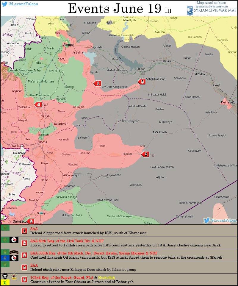
...
Yesterdays map showed pretty much what I expected to see, a split north and east at the crossroads as a prelude to taking the whole "block" of territory between the roads.
The solid green is going to be the position of the main column while the hatched area showing the fire zone and the operational areas for flanking units etc.
ISIS have been caught on the hop and must be pouring in any reinforcements they can find and trying to fortify these previously remote and quiet areas.
I would not be surprised if the SAA have found a hole in the above and are quietly sending a force through it.
I guess we should learn in the very near future.

")