
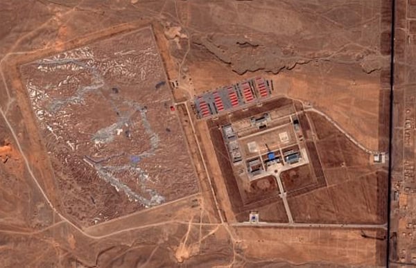
Can anyone provide any information or discussion on the following? We have what appears to be a military installation near the remote Chinese village of Huangyangtan with a large, very detailed scale model of mountanous landscape next to it...abut 900m by 700m. Here's two pictures of the installation and the a close up of the scale model.
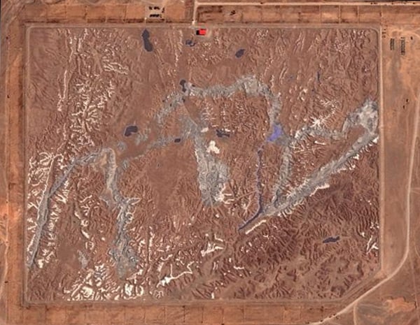
Now here's close up of a part of the scale model terrain, followed by the actual terrain that it represents as seen from Google Earth:
Any idea what this represents and is about. Is it purely a a geographic, geologic thing for the PRC or are their military implications. They went to a lot of trouble and expense to create this for some reason.
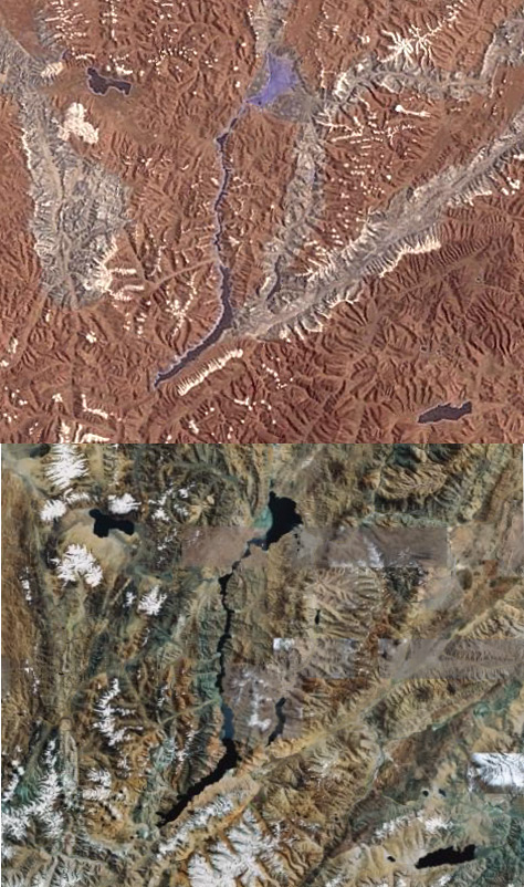


